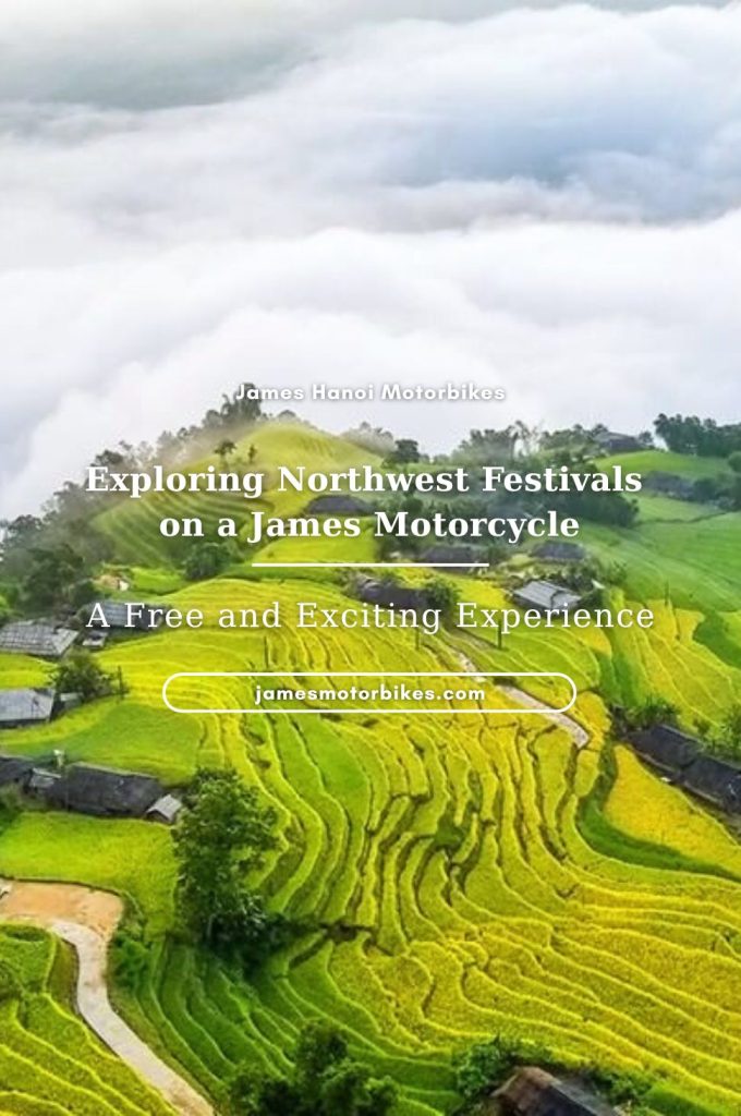
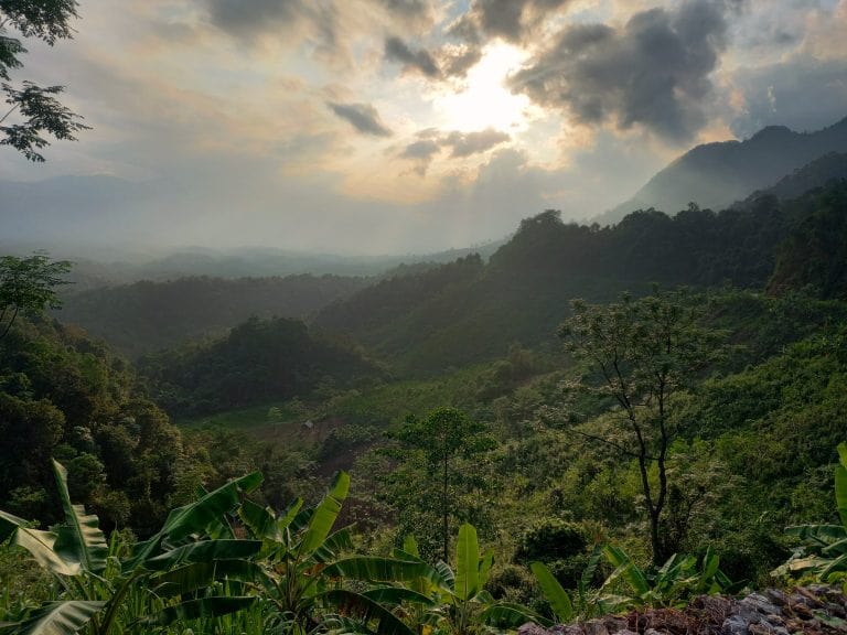
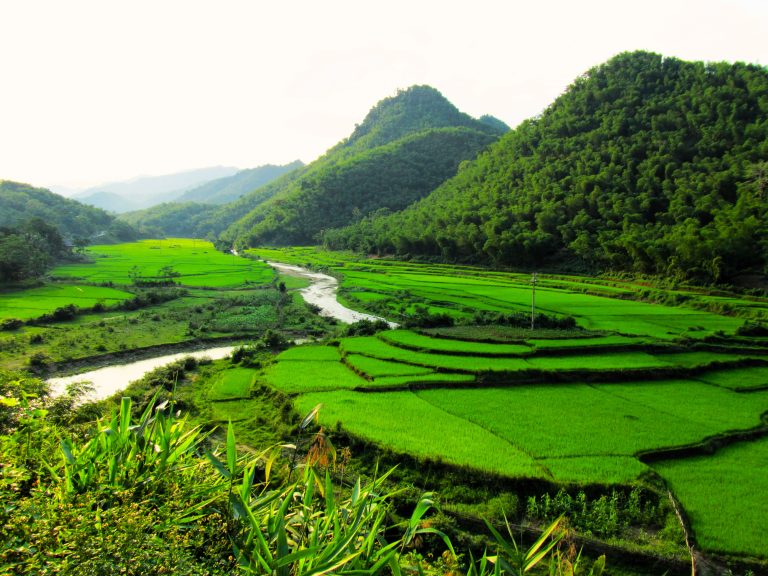
Just a few hours southwest of Hanoi is a landscape of soaring limestone mountains cloaked in bamboo forests and bisected by blue streams. The region’s most important geological feature is the mighty Mã River, a viscous, velvety body of water snaking through the karst mountains all the way from Laos. Quiet roads meander along steep valleys and mountain passes twist skyward toward remote Lao border crossings forming a network of spectacular riding roads. Straddling both Thanh Hóa and Hòa Bình provinces, the Limestone Loops consist of four separate, stand-alone motorbike loops, each of which can be ridden in one day on the road. Base yourself in Pù Luông or Mai Châu for a few nights and ride one loop each day and you’re guaranteed to fall head over heels for this region.
LIMESTONE LOOPS
4 Loops through Karst Scenery near the Vietnam-Laos Border
In this guide, I’ve outlined 4 different loops, all starting/ending at Bản Đôn village, at the heart of Pù Luông Nature Reserve. Each loop is designed to be ridden separately in one full day on the road. Base yourself at one of the many excellent accommodation options in Pù Luông (or Mai Châu, if you prefer) and ride one loop each day over the course of several days. (Or, if you want, you can combine all 4 loops to create one big loop, staying at various places along the way.) I have made separate maps for each of the 4 loops, as well as a map outlining route options between Hanoi and Pù Luông. The best time of year is March-May and September-October. Click an item below for details and maps. If you enjoy this guide, please make a donation or consider purchasing the Offline Guide & Map package.
ROUTE MAP
Limestone Loops | 4 Motorbike Routes
MAP LEGEND:
- Blue line: Spice Hills Loop
- Red line: Cascades Loop
- Purple line: Lao Loop (south)
- Orange line: Lao Loop (north)
About the Loops
Below is a brief at-a-glance overview of the Limestone Loops, followed by more specific details about important considerations, such as start/end points, accommodation, road conditions, traffic, food and drink, weather, connecting routes and more:
QUICK DETAILS:
- Route: 4 loops through limestone karst scenery around the Mã River valley, Pù Luông Nature Reserve & the Lao border
- Distance: 805km (all 4 loops combined)
- Duration: 4-6 days
- Scenery: limestone karst mountains, bamboo forests, rivers, caves, jungles, valleys, borderlands
- Attractions: caves, waterfalls, river swimming, villages, historic sites, bamboo waterwheels, scenic passes
- Road Conditions: good paved roads & narrow back-roads, light traffic, some rough patches
- Best Time: March-May, September-October
Getting to/from Hanoi: Although some riders will connect to the Limestone Loops from elsewhere, most people will likely be coming from Hanoi. I have written a separate section about this, including a route map: see below for details.
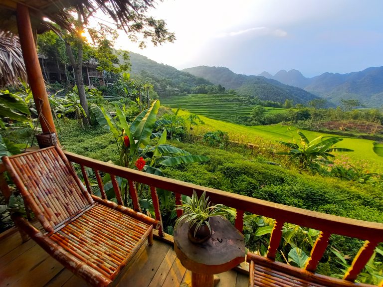
Start & End: Each of the 4 loops in this guide start and end at Bản Đôn village, located at the centre of Pù Luông Nature Reserve, where there are lots of great accommodation options (see my guide to Pù Luông Nature Reserve for details). The loops are designed to be ridden one by one, starting and ending each day from your base in Pù Luông. Personally, I can’t think of a better way to enjoy these motorbike loops than to begin each day with breakfast overlooking the rice terraces of Pù Luông, followed by several hours on the road exploring the loops, and arriving back in Pù Luông for a delicious local dinner (and perhaps a cocktail) watching the the sun set behind the limestone mountains. However, if you prefer, you can easily shift the daily start/end point of each loop to nearby Mai Châu (a lovely valley where there’s lots of good accommodation), or even tackle all 4 loops in one, staying at a different place each night. It’s up to you, but my recommendation is to find a good place to stay in Pù Luông and start/end each day and each loop there over the course of 4-7 days. This is a wonderful way to experience the region.
Using the Maps: This guide includes 6 separate maps: x1 showing all 4 Limestone Loops; x1 showing route options to/from Hanoi; and x1 map for each of the 4 individual loop: Spice Hills Loop, Cascades Loop, Lao Loop (south), Lao Loop (north). If you purchase the Offline Guide & Map you will receive pre-downloaded KMZ files for all 6 maps. If not, you can find all 6 maps imbedded in the relevant sections of the guide on this page.
Distances: The combined distance of all 4 loops is 805km, but the average distance of each individual loop is around 200km. See each loop for exact distances, maps and details.
Duration: I recommend riding one loop per day. As there are 4 loops, this would mean spending 4 days to complete all the Limestone Loops. However, you could easily spend up to 7 days riding the loops, especially if you choose to take some of the optional side routes and detours on my maps. Riders in a rush could complete the loops in as little as 2-3 days by combining some of the loops: for example, the two Lao Loops could be condensed into one Lao Loop. Bear in mind that the roads are winding and mountainous, making average speed relatively slow, and the scenery is so good that you will want to stop regularly to enjoy it. It is best to plan to spend a full day riding each loop.
Connecting Routes: The Limestone Loops link seamlessly with other excellent routes in the region, offering riders the chance to extend their road trip. These include, the Lam Sơn Loop, the Mường Lống Loop and the Ghost Road, as well as connecting to the Ho Chi Minh Road to the east.
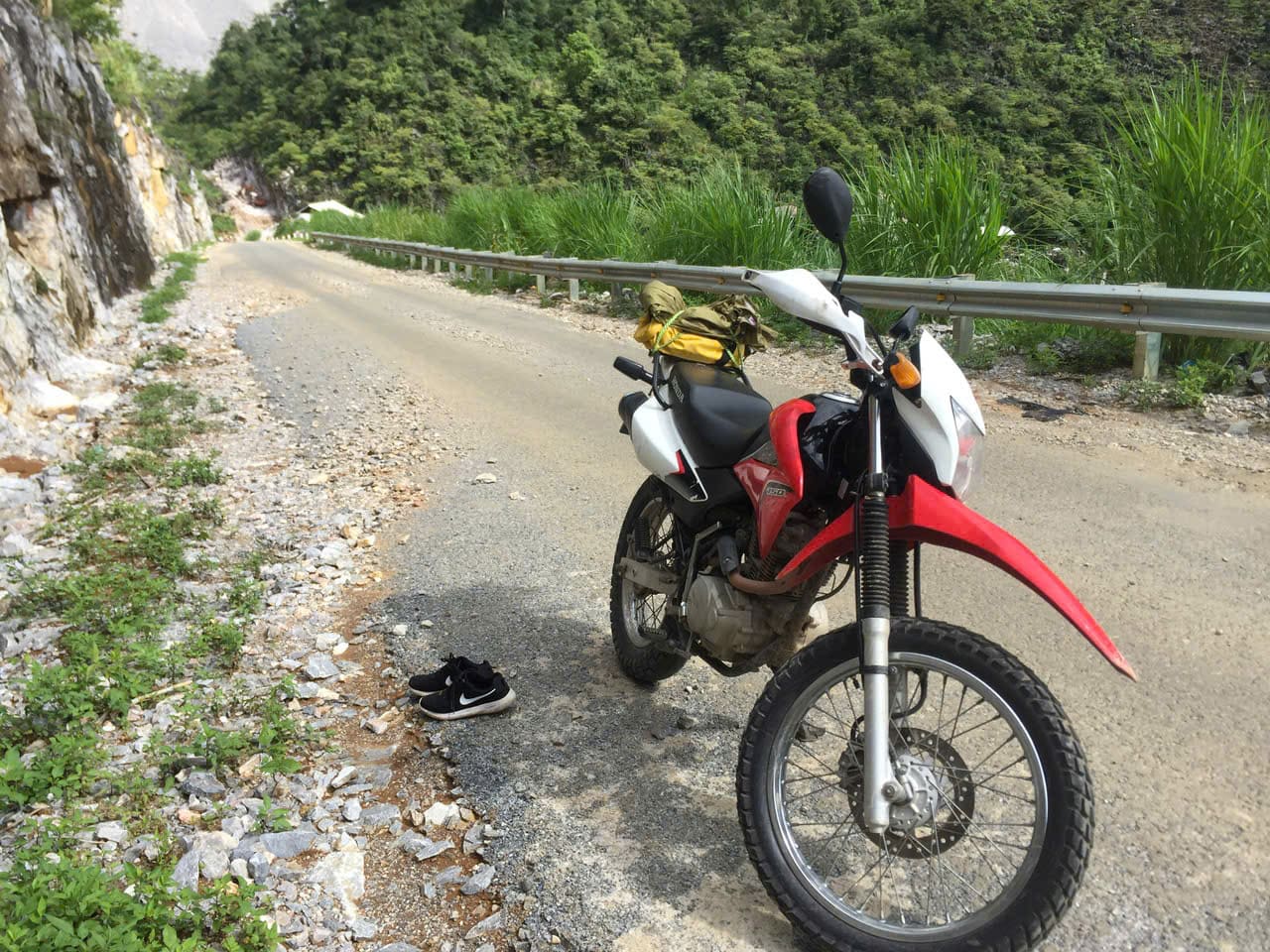
Traffic & Road Conditions: There’s only light traffic on all of the loops: in some cases, there are hardly any other vehicles whatsoever. However, trucks do ply the roads leading to the Lao border as trade between the two neighbouring communist nations is booming. Most of the roads – even the smaller back roads – are in pretty good condition: all paved, all rideable on any kind of motorbike. At the time of latest update, there were a few bumpy sections here and there, but nothing much to worry about, unless there’s been very heavy rainfall, in which case road conditions could deteriorate.
Gas Stations: There are gas stations at fairly regular intervals on all of the loops. However, some regions, especially the western areas towards the border with Laos, are quite sparsely populated and places to fill up are few. If riding one loop per day, most motorbikes will need to stop for gas once on each loop (assuming you start the day will a full tank). Most villages and towns marked on my maps with a red pin will have at least one gas station. But don’t let your fuel gauge get too low before looking to fill up.
Weather & Time of Year: Although it’s possible to ride the Limestone Loops at any time of year, the best time for weather conditions and scenery is spring (March-May) or early autumn (September-October). During the high summer months (June-August) it can be very hot with some heavy rainfall. In the winter (January-February) it can be surprisingly cold and grey, especially on the high mountain passes..
Accommodation: I highly recommend choosing an accommodation in Pù Luông or Mai Châu and using it as a base from which to ride the loops in this guide. Both Pù Luông and Mai Châu have lots of excellent places to stay in all price ranges. Find an accommodation that suits you and use that as your hub from which to explore the wider region by riding one loop per day. If not, there are a handful of local guest houses (nhà nghỉ) in most villages on the loops, as well as some homestays scattered here and there, such as Thác Mu and Thác Mây on the Cascades Loop. Note that at the time of research, foreign travellers were not allowed to stay overnight in the town of Mường Lát, on the Lao Loop (North)
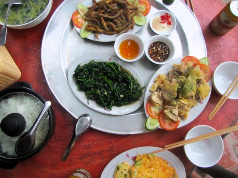
Food & Drink: Assuming that most riders will base themselves in Pù Luông or Mai Châu, the only meal you’ll be having on the road is lunch, and perhaps a snack or two. Most villages and towns on the loops have local cơm-phở (rice-noodle) eateries. If you want a proper meal, you’ll need to stop at the right time of day: lunch usually starts around 11am and is over by 1pm. Drinks and snacks are available at regular intervals from local stores. For breakfast and dinner, both Pù Luông and Mai Châu have lots of excellent places to dine.

Getting from/to Hanoi
If you want to start the road trip from Hanoi (rather than renting a motorbike in Pù Luông or Mai Châu), there are several potential routes to take from the capital. Although both Pù Luông and Mai Châu are less than 200km southwest of Hanoi, the ride can take between 4-6 hours, depending on weather, traffic, road conditions and which route you choose to take. Personally, I don’t really enjoy the ride from Hanoi, especially the first hour or two, which involves negotiating the capital’s clogged streets and then the truck-strewn industrial suburbs. However, this miserable urban sprawl serves are a remarkable juxtaposition to the beautiful natural setting of Pù Luông and Mai Châu. On my map below, I’ve marked two possible routes from Hanoi: main roads (blue line) and back-roads (red line). Both routes are the same distance at 195km. The main roads route is easier to navigate and the roads are bigger and wider, but there’s more traffic. The back-roads route utilizes quieter roads, passing more appealing scenery, going more off the beaten path, but there are still a couple of unpleasant sections and the possibility of minor road deterioration. Another option is to combine the two routes using various link roads. Personally, if the weather is good and time isn’t an issue, I would choose the back-roads route; if the weather is grim and all you want to do is get the ride over with, I would choose the main roads route. (For information about how to get from Hanoi to Pù Luông by bus, see my Pù Luông Nature Reserve Travel Guide.)
ROUTE MAP: Hanoi to/from Pù Luông (Bản Đôn village)
- Blue Route: main roads | 195km
- Red Route: back-roads | 195km

Route 1: Spice Hills Loop
QUICK DETAILS:
- Route: Pù Luông→Lũng Vân→Pù Bin→Mai Châu→Cun Pheo→Co Lương→Pù Luông
- Distance: 155km
- Duration: half or full day
- Road Conditions: good back roads, a few rough patches
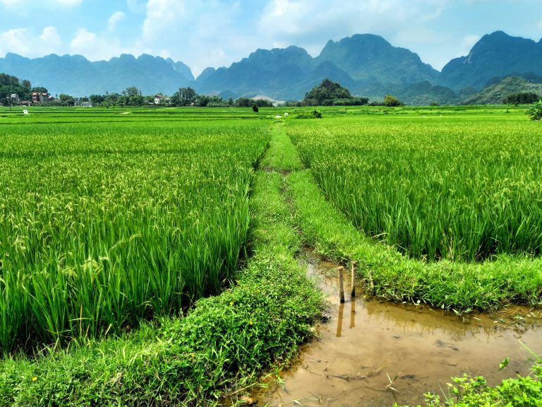
- Scenery: valleys, rice fields, misty mountains, high passes, limestone peaks, villages
- Attractions: caves, villages, views, wonderful scenery, back roads, good riding
ROUTE MAP: Spice Hills Loop | 155km
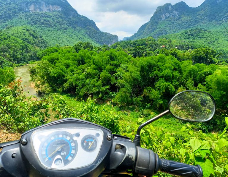
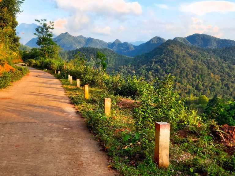
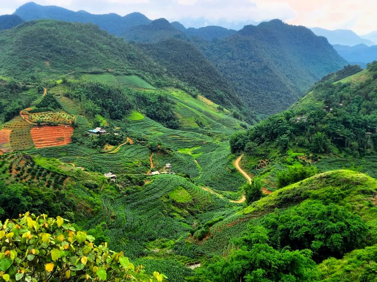
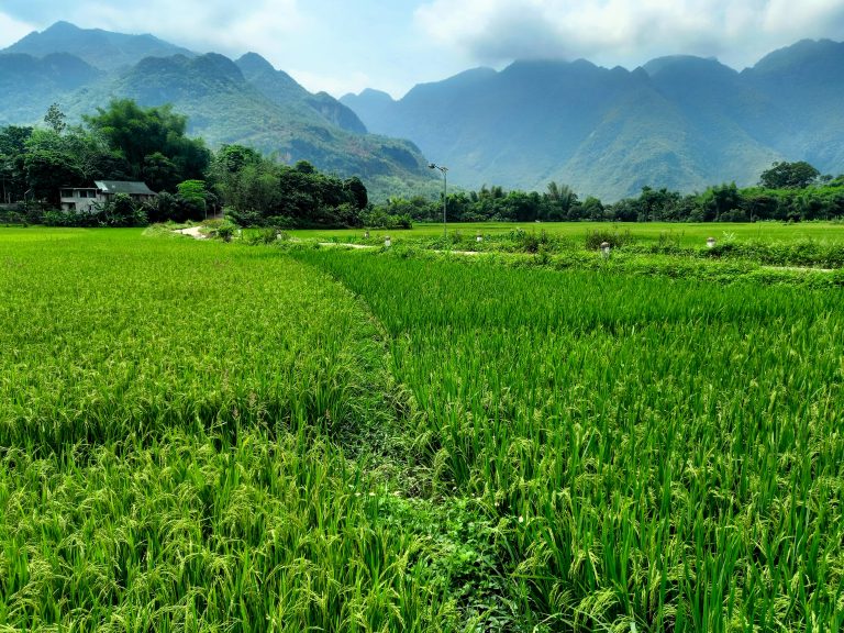
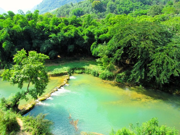
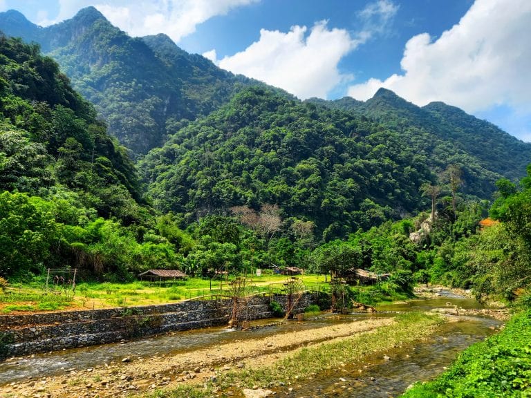
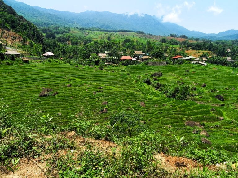
Description: The Spice Hills Loop can be ridden in either direction, but I prefer to go anti-clockwise on the loop. Heading south from Bản Đôn village and enjoying the views from the road across the misty valleys of Pù Luông Nature Reserve, the route sweeps northwards from the Làng Tôm intersection and on through Phố Đoàn village where the market is worth a stop if it’s early morning. Veering eastward, the road ascends an incredibly steep pass zigzagging up a sheer wall of limestone, affording panoramic views of the valley from each hairpin. Perched on a bend, a săn mây (‘cloud hunting’) cafe is a favourte spot for photographers to come in the early mornings when a mist lingers in the valley. The pass summits and cuts through a valley of limestone peaks before cruising across the Lũng Vân plateau. Turning due northwest at Lũng Vân village, the back road to Pù Bin and Noong Luông winds high above a deep, steep valley checked with soy, rice and spice fields. Even in the summer, there can be a chill in air up here. The last 10km before hitting the Thung Khe pass at Highway QL6 is a barren but beautiful landscape of rugged limestone pillars, reminiscent of Hà Giang.
Take the wide and weaving Thung Khe pass down to its base and turn due south on QL15 across a lush valley to Mai Châu village, where you can stop for some lunch, a coffee and pop into to the Thái Museum to learn about the Thái ethnolinguistic group that make up the majority of the population in this region. Head west from Mai Châu on a back road that goes from rice paddies in the valley to rainforests in the mountains within just a few kilometres. This is a great little road with no traffic and fabulous scenery. However, there are one of two patches of bumpy road surface and possibly some slippery mud if there’s been a lot of rain. Take it slow and continue all the way west to the remote little hamlet of Cun Pheo before swinging back around on a parallel road (again with some rough patches) back to QL15. Follow the muddy waters of the Mã River for a short while before turning due southeast onto QL15C, a spectacular road leading into the mountains and jungles of Pù Luông Nature Reserve. If you have time, take a detour to Kho Mương hamlet and visit Hang Dơi (Bat Cave), before returning to Bản Đôn village, thus completing the Spice Hills Loop.
IMAGES | Route 1: Spice Hills Loop

Route 2: Cascades Loop
QUICK DETAILS:
- Route: Pù Luông→Mường Khến→Cẩm Thủy→Ngọc Lặc→Cành Nàng→Pù Luông (+side routes)
- Distance: 196km (basic loop)
- Duration: full day
- Road Conditions: good paved back roads, wide highways, some rough patches
- Scenery: limestone mountains, lush valleys, waterfalls, rivers, villages, bamboo forests
- Attractions: waterfalls, river swimming, historic sites, homestay villages, passes
ROUTE MAP: Cascades Loop | 196km
Description: A full day on the road, with lots of optional detours and alternative routes, the Cascades Loop requires you to leave early in the morning if you want to complete the route in a day. Otherwise, you can consider an overnight stop on the loop: there are some good homestays around both Thác Mu and Thác Mây waterfalls, as well as local guest houses at most of the towns on the loop. The total distance is just under 200km, but if you want to add any of the side routes to waterfalls and sites (which you definitely should), then the loop with be approximately 250-300km. Make sure you plan accordingly. This route uses a combination of small back roads (mostly in good condition) and larger national highways, including a good section of the Ho Chi Minh Road. In addition to the optional side routes (marked in red on my map), there are many other potential roads to explore in this region. The more time you have, the better. You can ride the loop in either direction, but I prefer to go clockwise on the loop.
After leaving Pù Luông early in the morning, take the side route to Bản Hiêu waterfall, set amidst pretty scenery in a lovely valley. Back on the main loop, head north via the steep pass to Lũng Vân and then continue due north on a scenic (but a bit bumpy) mountain road leading over the limestone karsts, out of Pù Luông Nature Reserve, and descending to the agricultural plains where it joins Highway QL6 for a brief stint to the crossroads town of Mường Khến (Tân Lạc). Join QL12B for a smooth ride due southeast through a verdant valley filled with rice paddies all the way to the intersection with the Ho Chi Minh Road at Lạc Sơn. However, if you have time, definitely take the detour due south from road QL12B to visit Thác Mu waterfall, where there’s also a smattering of good accommodation for a night. Stay on the Ho Chi Minh Road heading due south all the way to Ngọc Lặc. The first section (from Lạc Sơn to Cẩm Thủy) is particularly good riding and scenery, flanked to the east by the old-growth forests of Cúc Phương National Park. A side route due west leads to Thác Mây waterfall, where there’s good river swimming and some homestay options. Another potential side route leads southeast from Cẩm Thủy to the 15th century ruins of Hồ Citadel. At Ngọc Lặc, turn due west on QL15 towards the village of Lang Chánh, where there’s another optional side route to Thác Ma Hào waterfall. North of Lang Chánh, the road hits the banks of the Mã River to Cành Nàng and back to Pù Luông.
IMAGES | Route 2: Cascades Loop

Route 3: Lao Loop (south)
QUICK DETAILS:
- Route: Pù Luông→Đồng Tâm→Quan Sơn→Na Mèo→Bo Cúng Cave→Quan Hóa→Pù Luông
- Distance: 205km
- Duration: full day
- Road Conditions: good, paved roads, very light traffic
- Scenery: bamboo forests, wide rivers, jungle-covered mountains, caves, valleys, villages
- Attractions: caves, border crossings, bamboo water wheels, waterfalls, river swimming, villages
ROUTE MAP: Lao Loop (south) | 205km
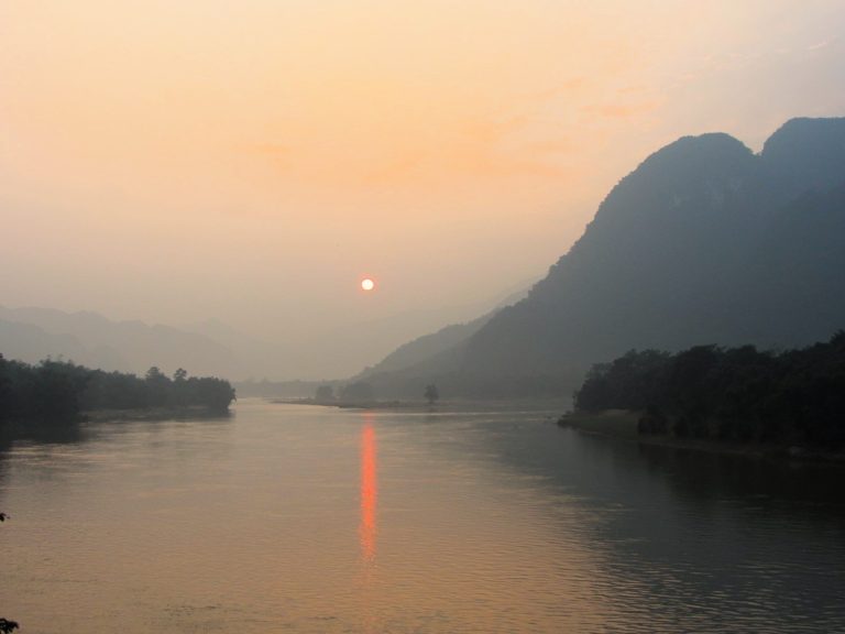
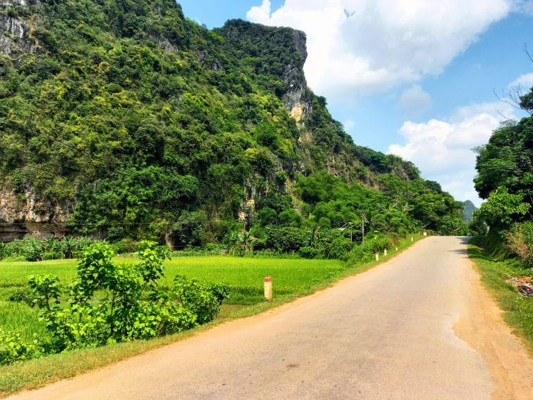
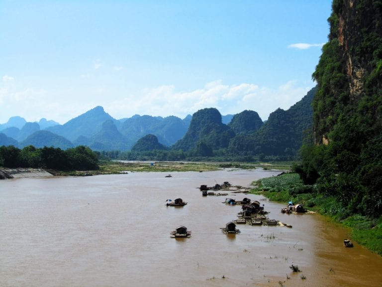
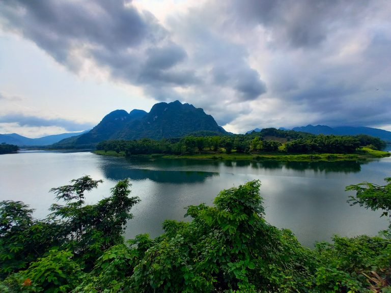
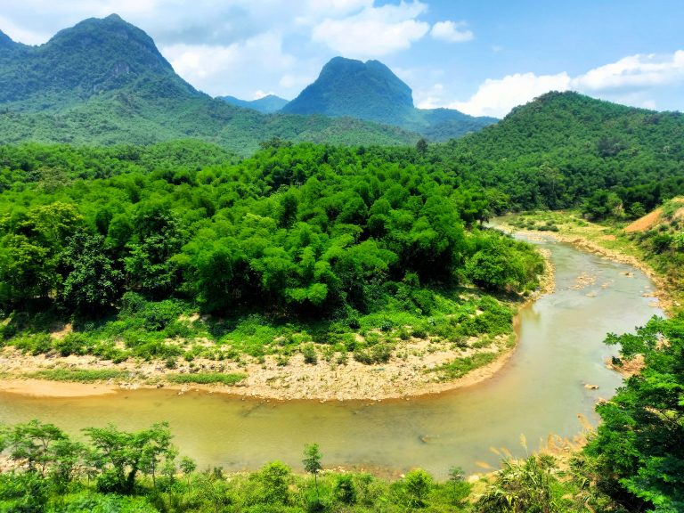
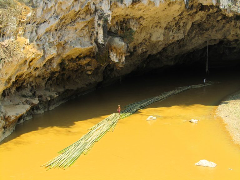
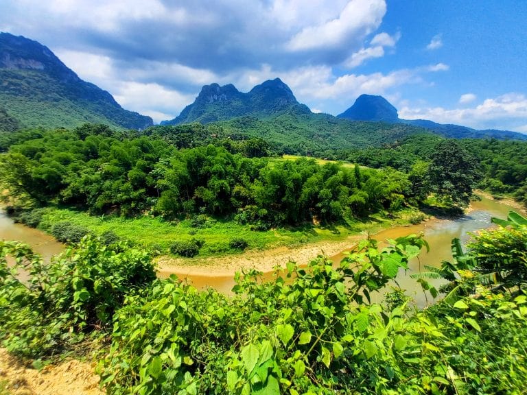
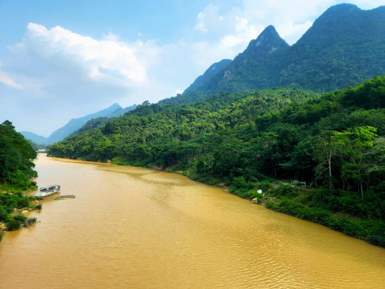
Description: A full day on the road, this highly scenic loop stretches west to the remote border with Lao via excellent roads and wonderful scenery. In addition to my loop, there are some back roads to explore, if you have the time. You can ride the loop is either direction, but I prefer to go clockwise on the loop. Ride south out of Pù Luông and across the wide arm of the Mã River, shadowing its southern banks for a while, through the crossroads village of Đồng Tâm to the intersection with QL217, and head west. The road immediately climbs high into the mountains before dropping into a lush valley and weaving a path along the banks of a river. Look out for a series of large bamboo water wheels on the riverbank at Trung Tiến hamlet. The town of Quan Sơn clings to the valley, offering a good lunch stop (there’s also accommodation if you need it). Continuing west, you enter the borderlands: traffic is very light, save for some trucks plying between Lao and Vietnam. If you have time, ride all the way west to the Na Mèo border crossing, which includes a good mountain pass. Otherwise, turn due north on a beautiful back road to Bo Cúng cave.
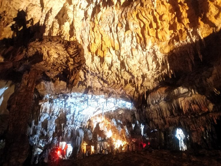
Situated in a valley surrounded by limestone karsts, Bo Cúng cave is isolated but in a very pretty spot and definitely worth a visit. A side lane leads down to the cave. Find the guard with the keys and ask to explore the cave. The entrance is diminutive but opens into a long series of chambers full of stalactites and stalagmites. The eerie beauty is enhanced by atmospheric lighting. Back at the cave entrance, take a quick swim in the river before getting back on the loop and continuing due north going up and down a spectacular pass and joining DT520. This smooth road runs alongside a verdant agricultural valley, past little hamlets and across the Mã River to Quan Hóa (Hồi Xuân). Before crossing the Mã, take a look at Hang Ma cave, where the chocolatey river water has carved out an overhang in the limestone karst that looms above. Quan Hóa town has some shops and local guest houses if you need them. If not, head due south on QL16, hugging the Mã River and then retracing the route back to Pù Luông.
IMAGES | Route 3: Lao Loop (south)
Route 4: Lao Loop (north)
QUICK DETAILS:
- Route: Pù Luông→Co Lương→Mường Lát→Tén Tằn border crossing→Quan Hóa→Pù Luông
- Distance: 248km
- Duration: full day
- Road Conditions: very good, some bumpy stretches, light traffic
- Scenery: rivers, lakes, mountains, borderlands, caves, jungles, valleys
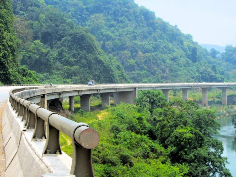
- Attractions: hydroelectric dams, river swimming, waterfalls, borders, villages, passes, great riding
ROUTE MAP: Lao Loop (north) | 248km
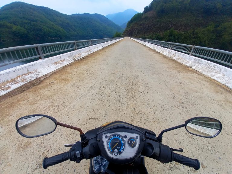
Description: This long and wide loop spreads west to the remote Lao border and requires a full day on the road. I prefer to ride it anti-clockwise on the loop, but either way is fine. Head due northwest from Pù Luông on QL15C, taking in the vistas across terraced rice fields and limestone peaks, to the intersection at Co Lương. Turn due west on Q16 following the Mã River whose flow is tempered by several huge hydroelectric dams, the last of which creates a placid lake that fills the valley. Road conditions get a bit bumpy for the second half of the route to Mường Lát. If it gets too uncomfortable, you can always use the QL16 cut through route to DT520 (marked in red on my map). The town of Mường Lát is an outpost on the Mã River; the last significant settlement before the Lao border. It’s a strange place, but there’s food, drink and some accommodation. However, at the time of writing, foreign travellers were not allowed to overnight here.
Turning due south from Mường Lát and then looping east on DT520, the road soars into the clouds on a long and winding pass known as Cổng Trời Mường Lát (Heaven’s Gate Pass). This excellent road leads across the mountains and through the valleys all the way to Quan Hóa (Hồi Xuân) on the Mã River. From here, turn north on QL15 and follow the river back to the Co Lương intersection and retrace the route back to Pù Luông, thus completing the loop.
IMAGES | Route 4: Lao Loop (north)
Source of the article: Vietnam Coracle