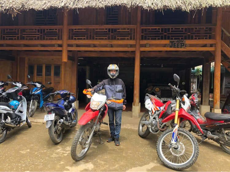
One of the most famous road names in the world, the Ho Chi Minh Road traverses the mountainous western spine of Vietnam – abutting both Cambodia and Laos – connecting Saigon (Ho Chi Minh City) in the south with Hanoi in the north. Not to be confused with the Ho Chi Minh Trail (most of which is actually in Laos), the Ho Chi Minh Road is fully paved along its entire 1,880km length, offering an unbroken stretch of road from south to north through some of the most spectacular scenery in Vietnam. At its best, the Ho Chi Minh Road is a thread of asphalt winding into the distance with such organic grace that it appears part of the natural landscape. Although ‘Ho Chi Minh Road’ is a name redolent of war, for those who ride it today, their lasting impression is of the majesty of nature: jungles coating mountains like melted wax, rivers filling valleys like veins of cobalt, and limestone pillars rising like crenellated fortifications along the Cambodian and Lao borders. I’ve been riding up and down the Ho Chi Minh Road since 2009 and it continues to thrill me.
HO CHI MINH ROAD
A Complete Guide to an Historic Route
In this comprehensive guide to the entire length of the Ho Chi Minh Road, covering 1,880km from Saigon to Hanoi, I’ve included an annotated route map, quick at-a-glance details, an overview of important considerations, such as distance, duration, weather, accommodation, etc., and fully illustrated descriptions of each section of the route. As this is a very long road trip, I’ve divided my guide into 3 Parts: Southern, Central and Northern. These are then subdivided into 8 Sections (see Contents below). Riders can choose to ride the whole route or just parts of it, but if you only ride one stretch of the Ho Chi Minh Road, make sure it’s the Central Part (sections 3-6), which is where the very best scenery and riding can be found.
Route Map:
Ho Chi Minh Road | 1,880km
Blue Line: Ho Chi Minh Road | Red Lines: bypasses

The Ho Chi Minh Road
Overview & Details:
Below is a brief at-a-glance overview of the Ho Chi Minh Road, followed by more specific details about important considerations, such as time, distance, duration, accommodation, traffic, food and drink, weather conditions and more:
QUICK DETAILS:
- Route: an historic road traversing the mountainous western spine of Vietnam from Saigon to Hanoi
- Distance: 1,880km (full route)
- Duration: 2 weeks (full route)
- Scenery: agricultural plateaus, jungles, limestone mountains, river valleys, borderlands, highland cities & villages
- Attractions: caves, waterfalls, historic sites, mountain passes, war remnants, good riding, remote villages
- Road Conditions: mostly good, wide, paved roads; some narrow sections, mostly light traffic; some busy sections
- Best Time: March-September
ABOUT THIS ROUTE:
Start & End: The start/end of this route is Saigon (Ho Chi Minh City) in the south and Hanoi, the capital, in the north. You can ride the Ho Chi Minh Road in either direction; it makes no difference. Although, technically the Ho Chi Minh Road doesn’t actually start/end in the heart of these two cities, I have chosen the city centres as the start/end point because it is most convenient to do so. In fact, the Ho Chi Minh Road continues further south of Saigon and further north from Hanoi, but only some sections of those are completed. Riding the entire length of the Ho Chi Minh Road is a great road trip, but it’s also possible to join the road at almost any point along its length by taking one of the many east-west roads that link the mountains with the coast. If you only ride one stretch of the Ho Chi Minh Road, make sure it’s the Central Part (sections 3-6), as this is one of the best rides in Vietnam, including the jaw-dropping Western Ho Chi Minh Road (section 5) between Khe Sanh and Phong Nha.
Distances & Duration: The total distance of the Ho Chi Minh Road from Saigon to Hanoi is 1,880km. If you want to ride the entire route, 2 weeks is about right. But it depends how you want to ride: long distances on consecutive days or shorter distances with stops for a couple of nights at interesting destinations. For reference, a long riding day on Vietnamese roads is 200km-400km; a reasonable day is 100km-200km.
Itineraries & Sections: I have written and arranged this route going from south to north, starting in Saigon and ending in Hanoi. However, you can ride the Ho Chi Minh Road in either direction – it makes no difference. I have divided the Ho Chi Minh Road into 8 Sections (see Contents). It is possible to treat each of these sections as one day on the road, but it is not necessary to do so: you can plan your itinerary however you like. As a general rule, the more flexible you are, the better your road trip will be. The only section that you really need to plan ahead for is Section 5, which is the Western Ho Chi Minh Road between Khe Sanh and Phong Nha, where there is just one place to stay and one gas station.
Using the Map: My route map has the entire 1,880km-length of the Ho Chi Minh Road from Saigon to Hanoi marked with a blue line. In addition, the red lines are bypasses which lead around major towns on the route. I’ve also marked all major cities and towns with a red pin as well as dozens of sights and accommodations along the way. To use the map and guide offline with navigation, you can purchase the Ho Chi Minh Road Offline Map & Guide at the top of this page.
Weather & Time of Year: As the Ho Chi Minh Road covers the length of the nation and is so mountainous, it is difficult to determine the best time of year to ride it. However, weather conditions from March to September are generally the most favourable. From October to February, there’s a high chance of grey and damp (and even cold) conditions anywhere north of Prao (sections 4-8). Vietnam’s climate is very complex and often misrepresented by the travel media. Take a look at my Weather Guide to better understand the seasons and climate throughout the nation.
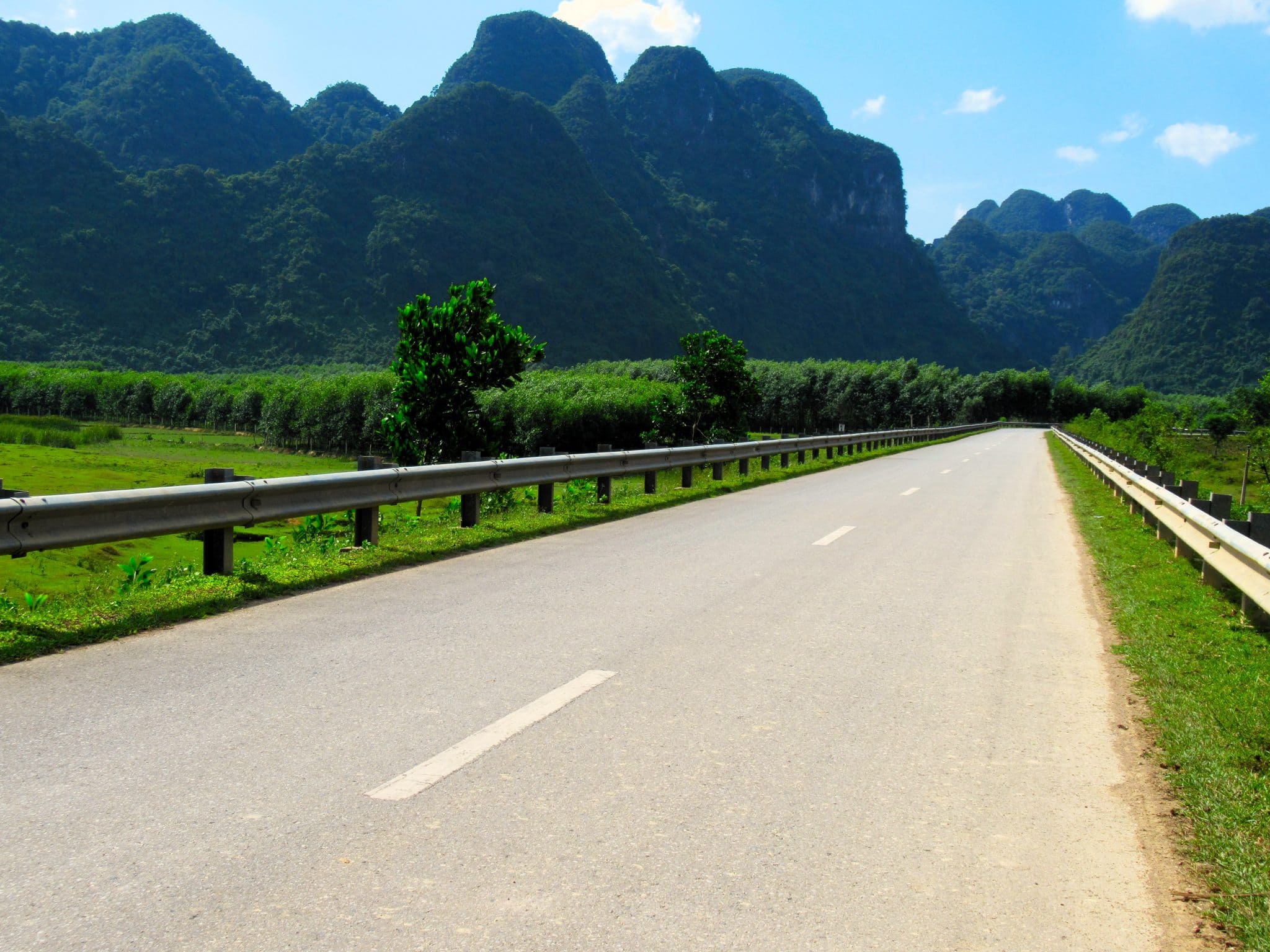
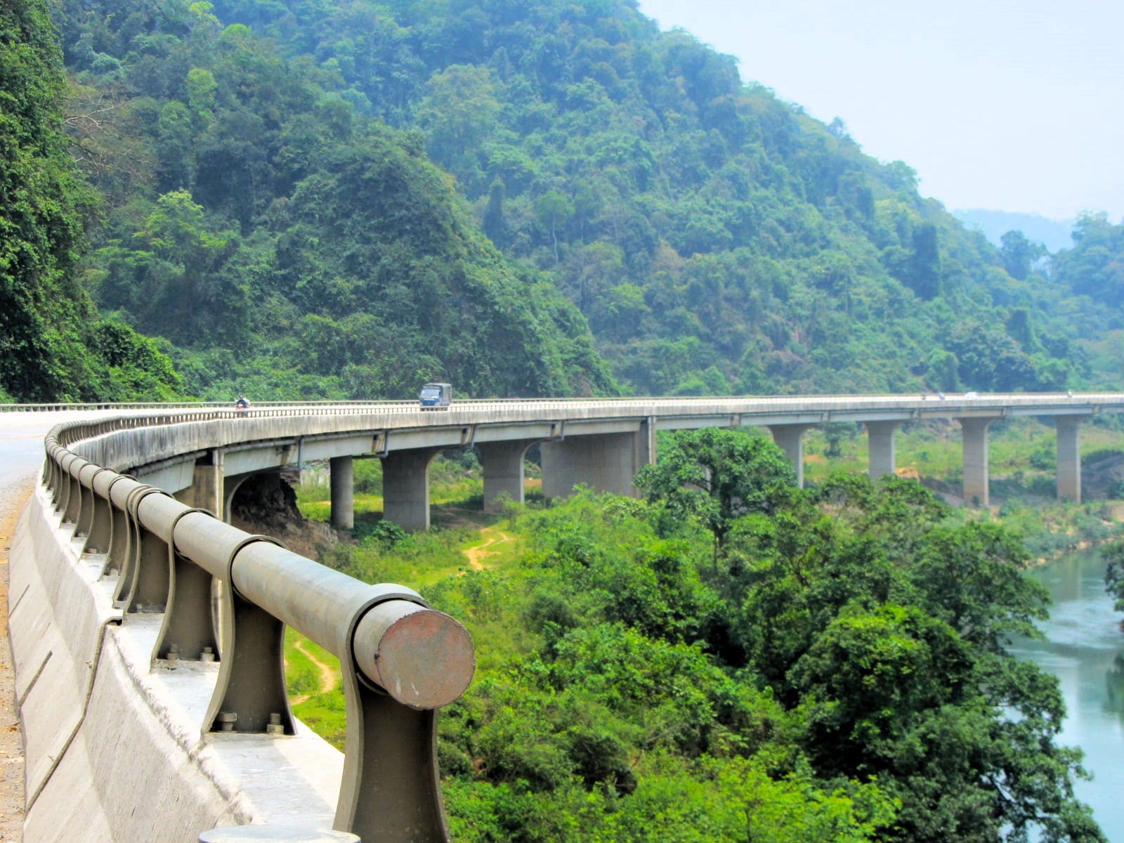
Traffic & Road Conditions: For much of its length, the Ho Chi Minh Road is a relatively quiet, well-maintained, two-lane highway which sees very little traffic compared to other major north-south routes, namely Highway 1 (QL1A). What’s more, many of the major cities and towns where traffic tends to bottleneck, especially in the southern sections, are bypassed by new ring roads (the red lines on my map). By far the quietest and most remote stretch is the Western Ho Chi Minh Road between Khe Sanh and Phong Nha (Section 5). This is also significant because it is the only section that’s fairly narrow and made primarily of concrete slabs.
Gas Stations: Throughout its entire length, gas stations are pretty frequent on the Ho Chi Minh Road. Nevertheless, it’s best not to let your fuel gauge get into the red before looking to fill up. The only exception is, again, the Western Ho Chi Minh Road between Khe Sanh and Phong Nha (Section 5). This 240km stretch only has one gas station, and even that is sometimes closed.
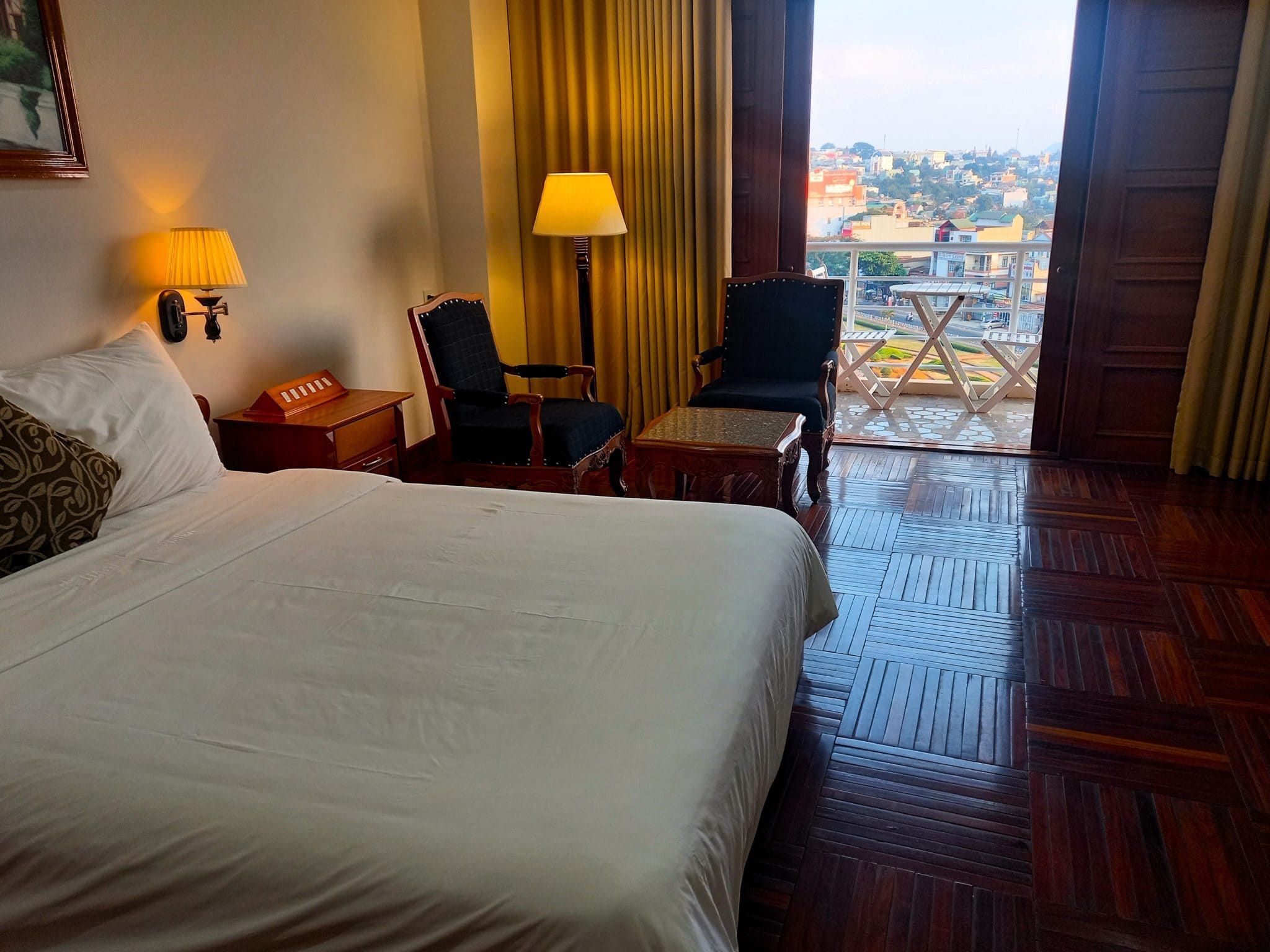
Accommodation: There are places to stay at almost every city, town and village marked on my map with a red pin. Obviously, the bigger cities have a greater range of accommodation; some of the smaller settlements may only have one or two local guest houses (nhà nghỉ). I have marked dozens of specific places to stay on my map with an orange bed pin, but these are just some examples of what’s available. Unless you are travelling during a public holiday or want to stay in a specific place, there’s no need to book accommodation in advance. The only stretch of road where there is very limited accommodation is the Western Ho Chi Minh Road (Section 5), between Khe Sanh and Phong Nha, where there is just one option to overnight, which is the Trường Thành Hotel in Long Sơn.
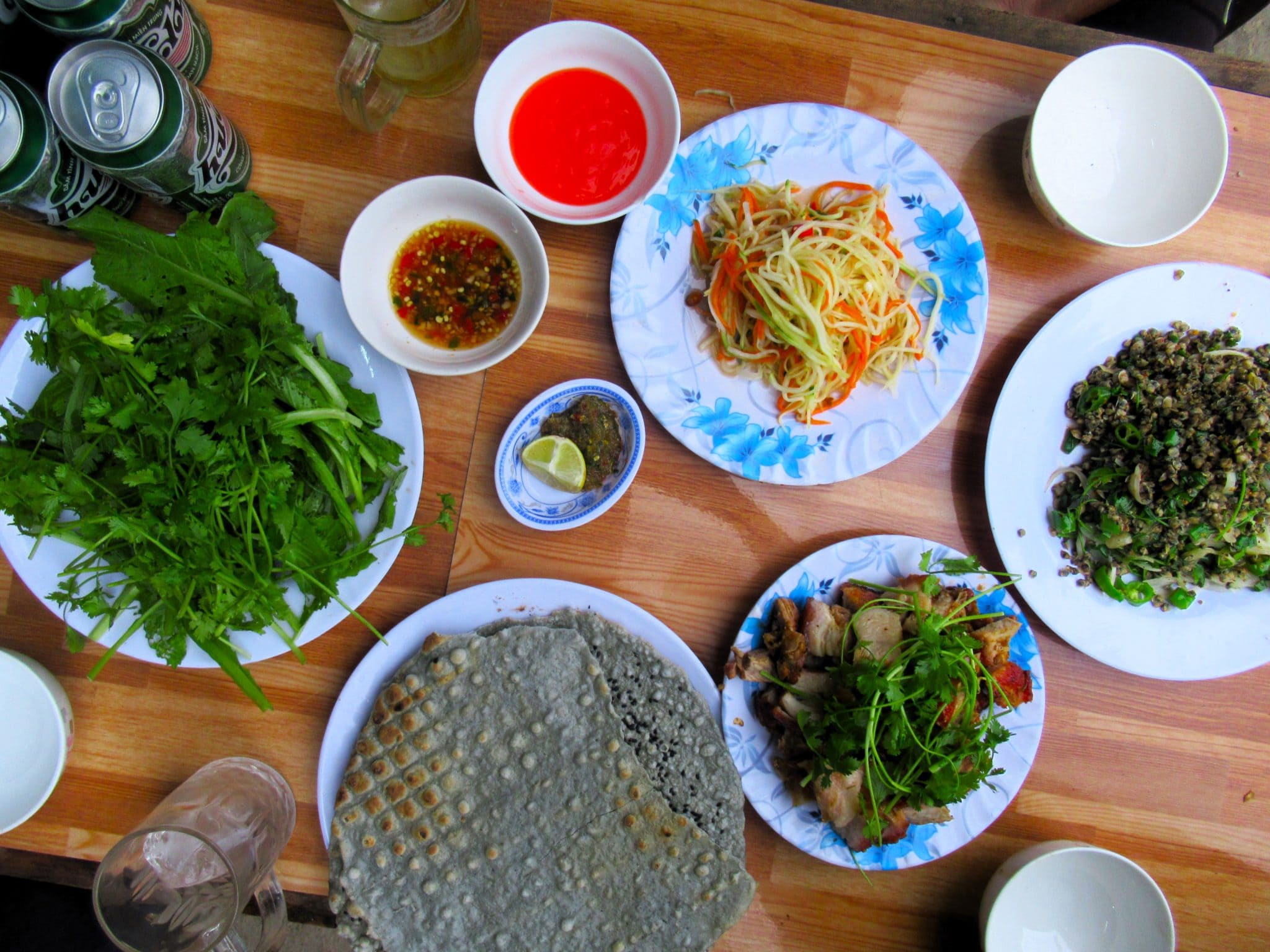
Food & Drink: There are plenty of dining and drinking options in the cities, towns and villages along the Ho Chi Minh Road. Obviously, the cities have the widest variety, but even the smaller villages have at least a handful of cơm-phở (rice and noodle) eateries. The only stretch where this isn’t the case is the Western Ho Chi Minh Road, between Khe Sanh and Phong Nha (Section 5). On this stretch, it’s wise to take a picnic, because there’s very little to eat for most of the 240km ride, beyond pot noodles and various sweet snacks.
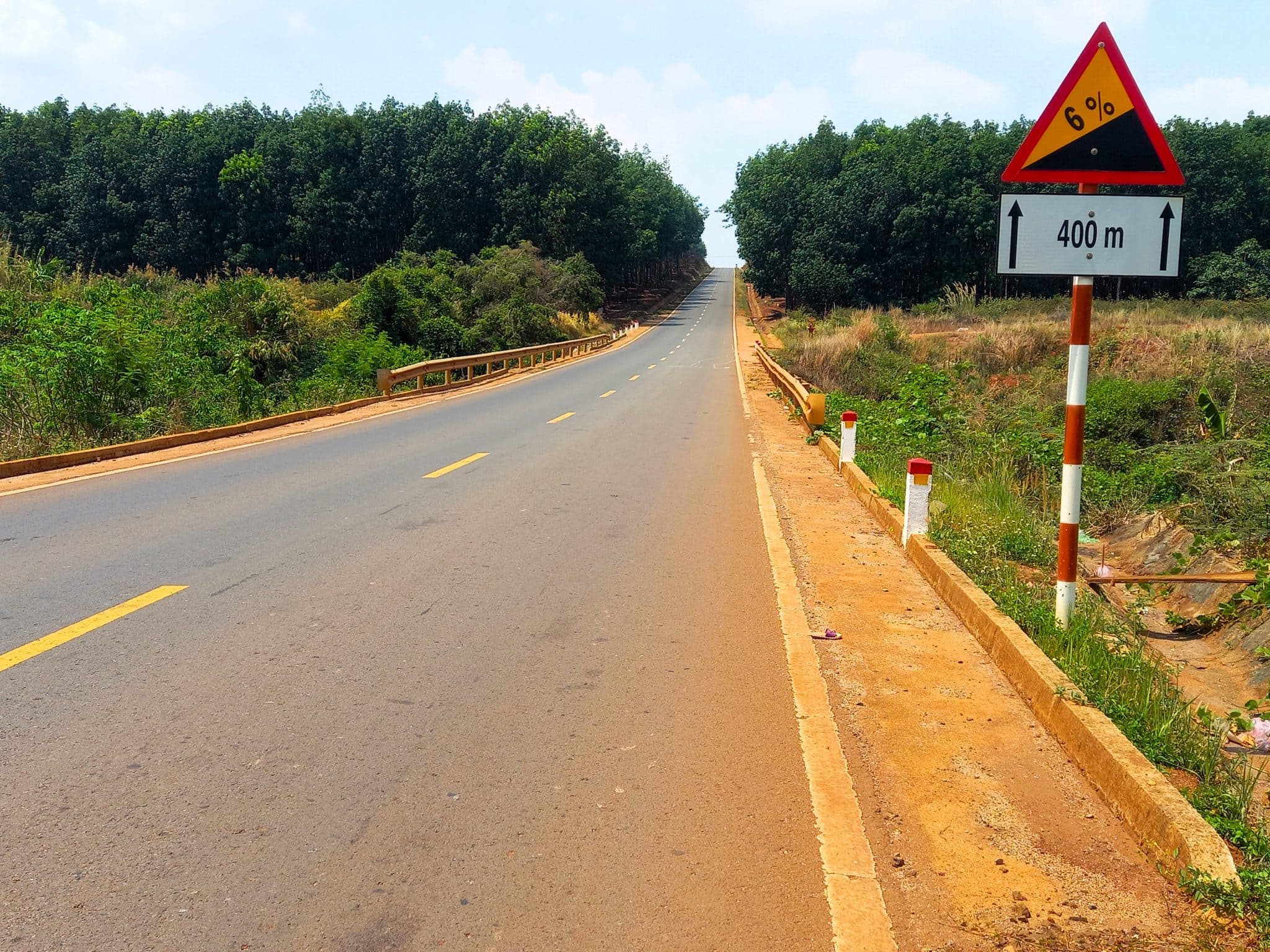
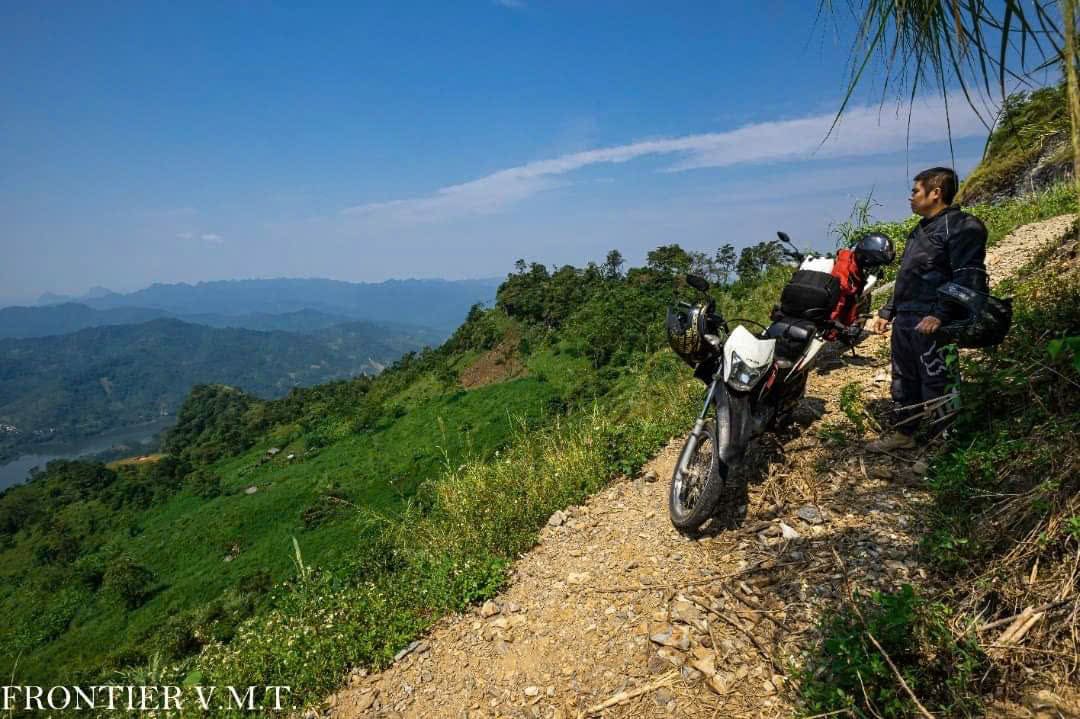
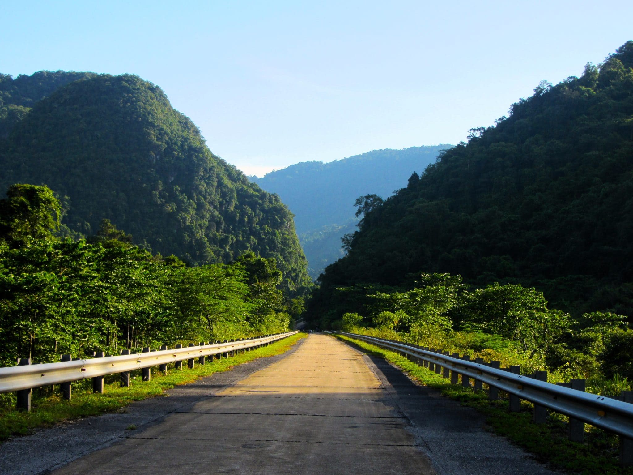
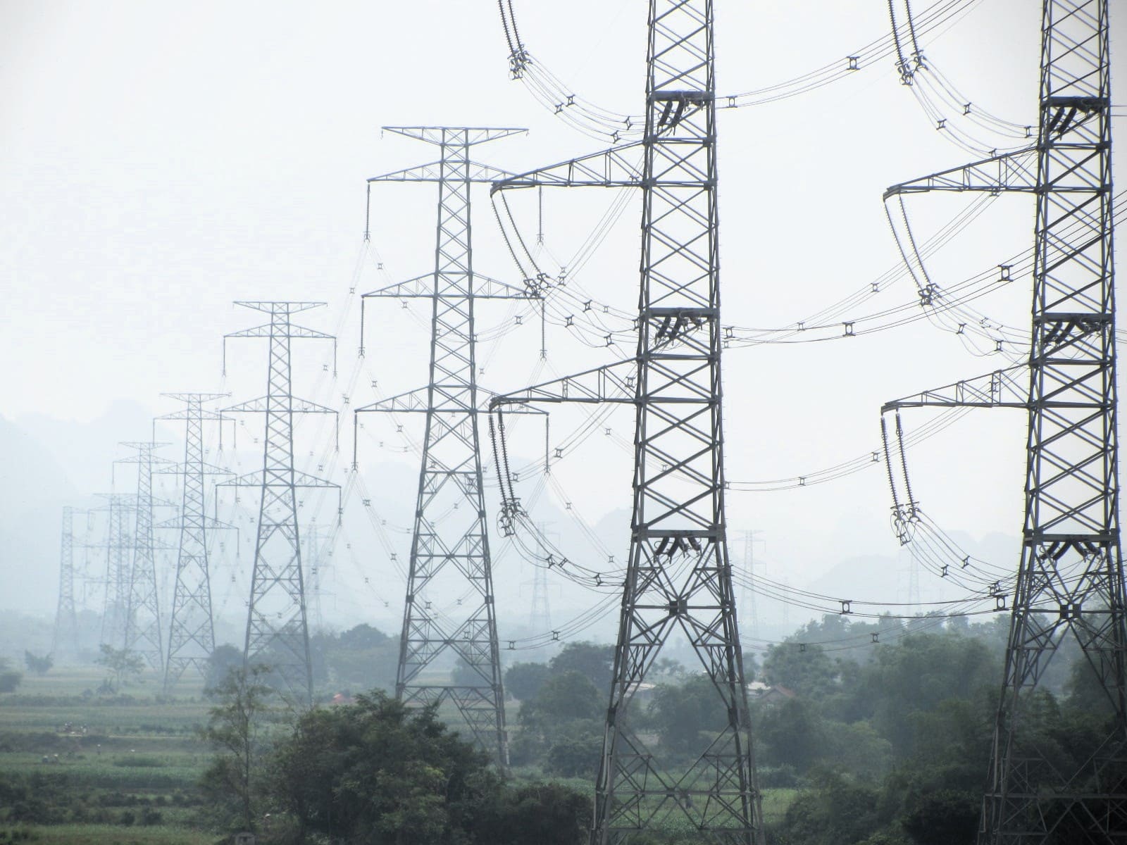
 Traffic is light for long stretches of the Ho Chi Minh Road
Section 1:
Saigon→Đồng Xoài→Gia Nghĩa→Buôn Ma Thuột | 340km
[View Map]
There are many ways to ride out of Saigon (Ho Chi Minh City) due north via the industrial hub of Bình Dương to the beginning of the Ho Chi Minh Road proper. Unfortunately, no matter which route you choose, it is a rather unpleasant 90-minute ride through factory towns and truck-clogged highways. However, if you take the route I suggest on my map, via the impressive ‘new cities’ of Bình Dương and Bến Cát, the roads are mostly wide and well-maintained, and if you leave early in the morning (before 5am), then the journey is bearable enough. You could even take a brief detour to the haunting ruins of Cầu Sông Bé Bridge.
At the intersection with QL13, turn due east onto the Ho Chi Minh Road: this is the start of the road that will take you all the way north for 1,800km. The road glides through acres of rubber plantations and there are already signs of the rich red soil that characterizes the Central highlands – even the light has a reddish tinge to it. After passing through the bustling town of Đồng Xoài (literally ‘Mango Field’) the road begins its slow climb up to the fertile plateaus of Đắk Nông and Đắk Lấk provinces. It’s easy to forget just how big Vietnam is: here, at one of the widest points of the nation, the landscape is broad, open and undulating as it stretches all the way west to the Cambodian border. As the road ascends, the air cools slightly, the sun feels more intense, the light get sharper, and fruit plantations carpet the landscape – cashew, jackfruit and rubber – punctuated by several gigantic bauxite mines. The scenery is not spectacular, but it is interesting, agricultural and vast. Traffic is not too bad, but trucks regularly ply this section, transporting agricultural products from the highlands to the cities and ports on the coast. Gia Nghĩa, the capital of Đắk Nông Province, is a good place to overnight with several accommodation options, food, cafes and the striking Liên Nung Waterfall nearby.
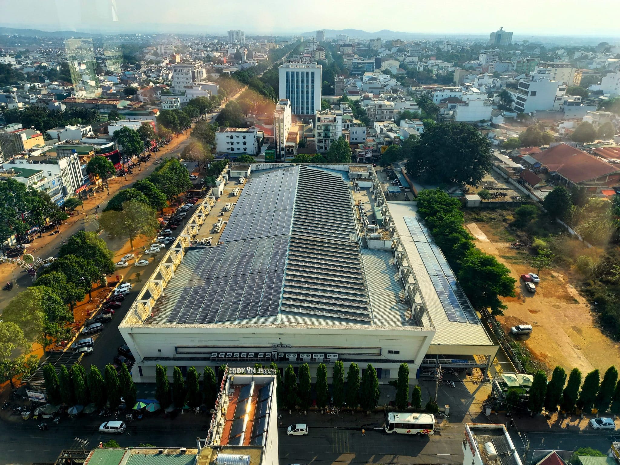
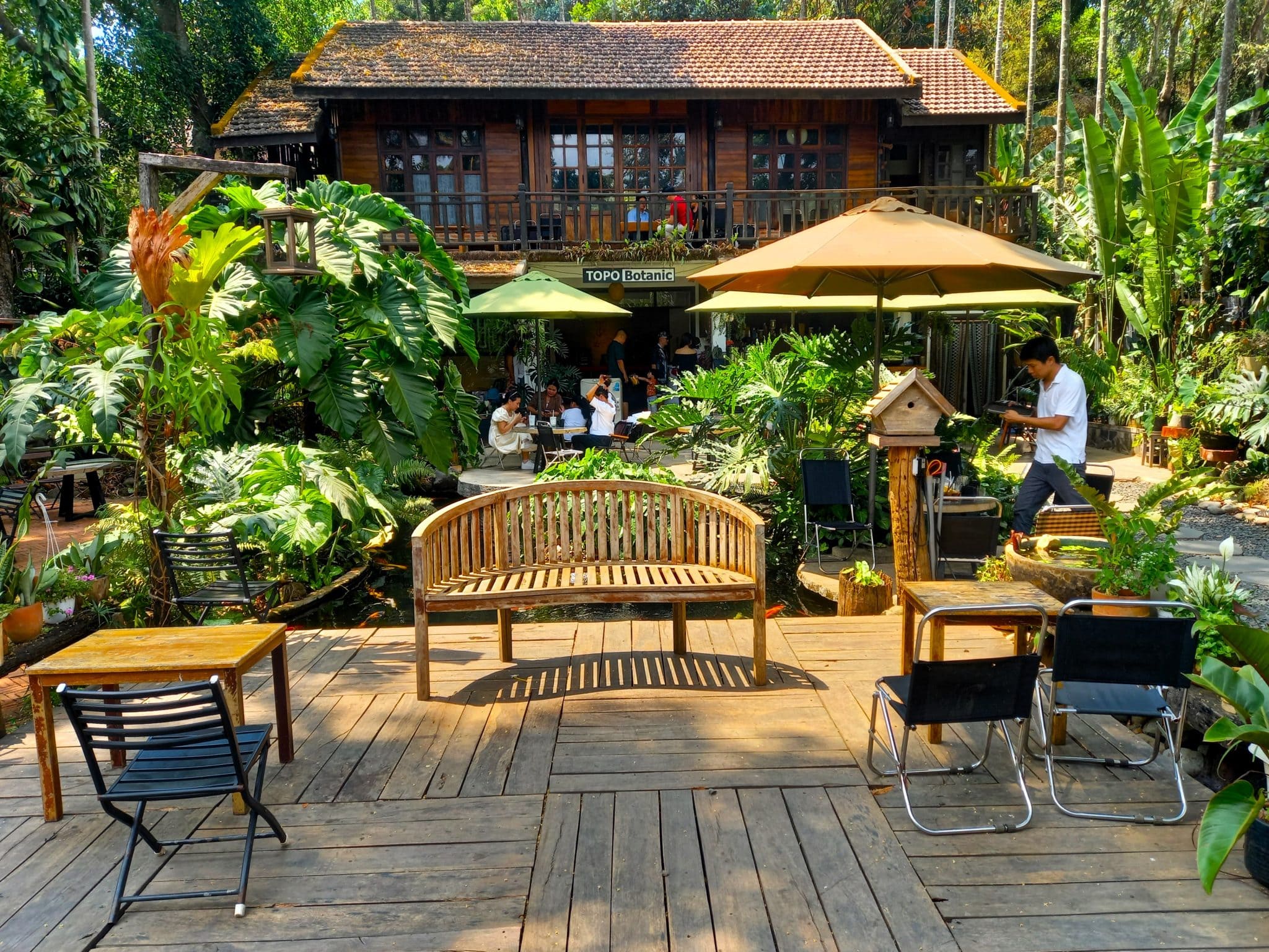
North of Gia Nghiã, the Ho Chi Minh Road ascends into scruffy pine forests before skirting the Cambodian border near Đắk Mil, then veering northeast towards Buôn Ma Thuột, the largest city in the Central Highlands. This is the coffee growing capital of Vietnam: the vast plateaus are blanketed in coffee bushes, as well as cacao and tropical fruits. The landscape in this region is dotted with extinct volcanoes which make the soil rich and fertile. Post 1975, there was a government push to populate this area which has led to a densely cultivated, productive, agricultural landscape. Although the scenery isn’t particularly inspiring, the road surface is excellent and the riding is a joy, meandering on a river of asphalt to Buôn Ma Thuột, a busy and increasingly prosperous city with lots of hotels, food and excellent coffee shops to sample the local product, such as Topo Botanic Garden.
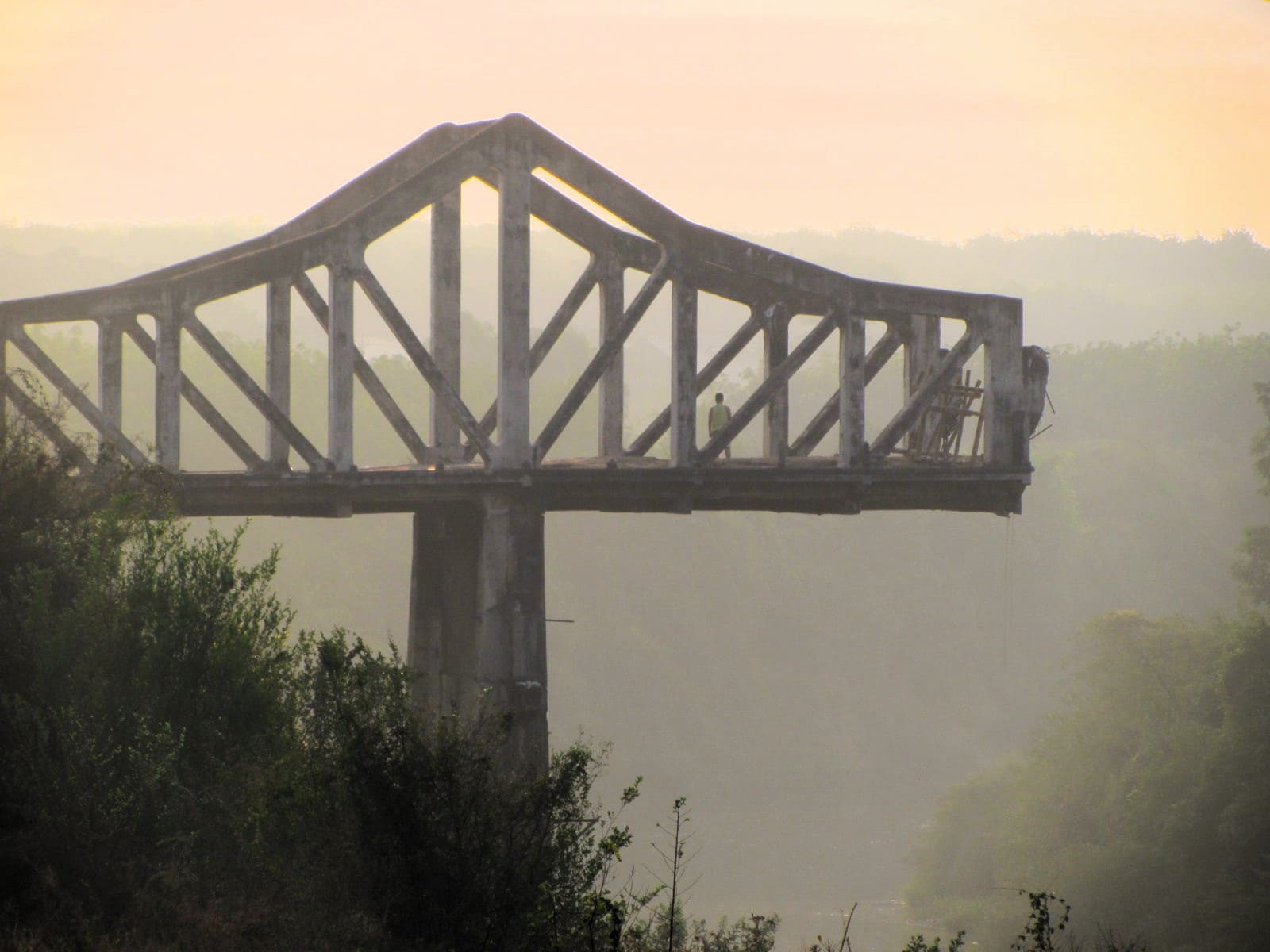 The evocative ruins of Cầu Sông Bé Bridge
 The start of the Ho Chi Minh Road, near Bình Dương
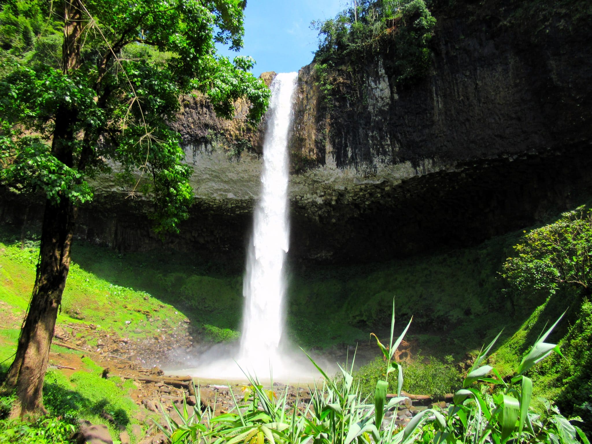
Section 2:
Buôn Ma Thuột→Pleiku→Kon Tum | 230km
[View Map]
The stretch of the Ho Chi Minh Road between Buôn Ma Thuột and Kon Tum is a straight shoot across vast agricultural plateaus, past thriving highland towns and cities, and a landscape that was once the scene of heavy fighting. Even though some of the towns in this section are congested, new bypasses (see the red lines on my map) now sweep around them in spectacular fashion, creating some great riding roads. The enormous undulating plateau is broken regularly by the vertical monoliths of wind turbines, rotating slowly across the landscape. The scenery may not be pretty but road conditions are excellent as the asphalt soars across the plateau, slicing through plantations where clouds of yellow butterflies drift across the road.
Heading north from Buôn Ma Thuột, the road plunges through miles and miles of coffee and pepper farms, passionfruit orchards and rubber plantations stretching to the horizon. The neat ranks of spindly rubber trees, standing erect on the hillsides, look like formations of a medieval army on a battlefield, waiting for the fighting to commence. Indeed, a battle did take place in these hills, some 60 years ago, between American forces and the North Vietnamese Army. In 1965, in the Ia Đrăng Valley to the west of the Ho Chi Minh Road, hundreds of US troops and thousands of Vietnamese were killed fighting under a deluge of bombs from B52s, in what was the first direct conflict between the two sides of what became known, in the West, as the ‘Vietnam War’, but what is known in Vietnam as the ‘American War’. Today, the Ia Đrăng Valley is an especially dry place: the earth is red and has a crisp, burnt crust to it and the colours are washed out, even the distant peaks are beige and arid.
Pleiku is a large, busy city, capital of the second biggest province in Vietnam, Gia Lai. Even though it’s not a particularly attractive city, there’s lots of accommodation here, a decent cafe scene and plenty of food options, making it a fine place to overnight. However, given the choice, the next town, Kon Tum, is a better option. Between Pleiku and Kon Tum, the Ho Chi Minh Road is arrow-straight, passing several dormant volcanoes until the plateau finally gives way to lush mountains and valleys surrounding the Đăk Bla River. Kon Tum, peaceful during the day and pleasantly abuzz in the evenings, is located on the riverside with some good cafes, hotels, street food, interesting architecture and even a couple of cocktail bars. Don’t miss the impressive bamboo interior of Indochine Coffee, one of many works by Võ Trọng Nghiã who is Vietnam’s best-known architect. For a drink, drop by the speakeasy-style The Witch’s Cocktail Bar.


Section 3:
Kon Tum→Khâm Đức→Prao | 280km
[View Map]
North from Kon Tum the Ho Chi Minh Road rolls through a heavily farmed and surprisingly densely populated landscape to Đắk Tô, scene of some of the fiercest battles of the American War. The countryside still bears the scars of all the bombs and defoliants that were dropped on the hills and forests here during the autumn of 1967. Just after Đắk Tô town, the road runs parallel with an abandoned US airstrip, now used by local farmers to dry their crops. As the road bears west, the next stop is the dusty crossroads town of Ngọc Hồi, gateway to the the triple international border crossing between Vietnam, Cambodia and Laos at Bờ Y.
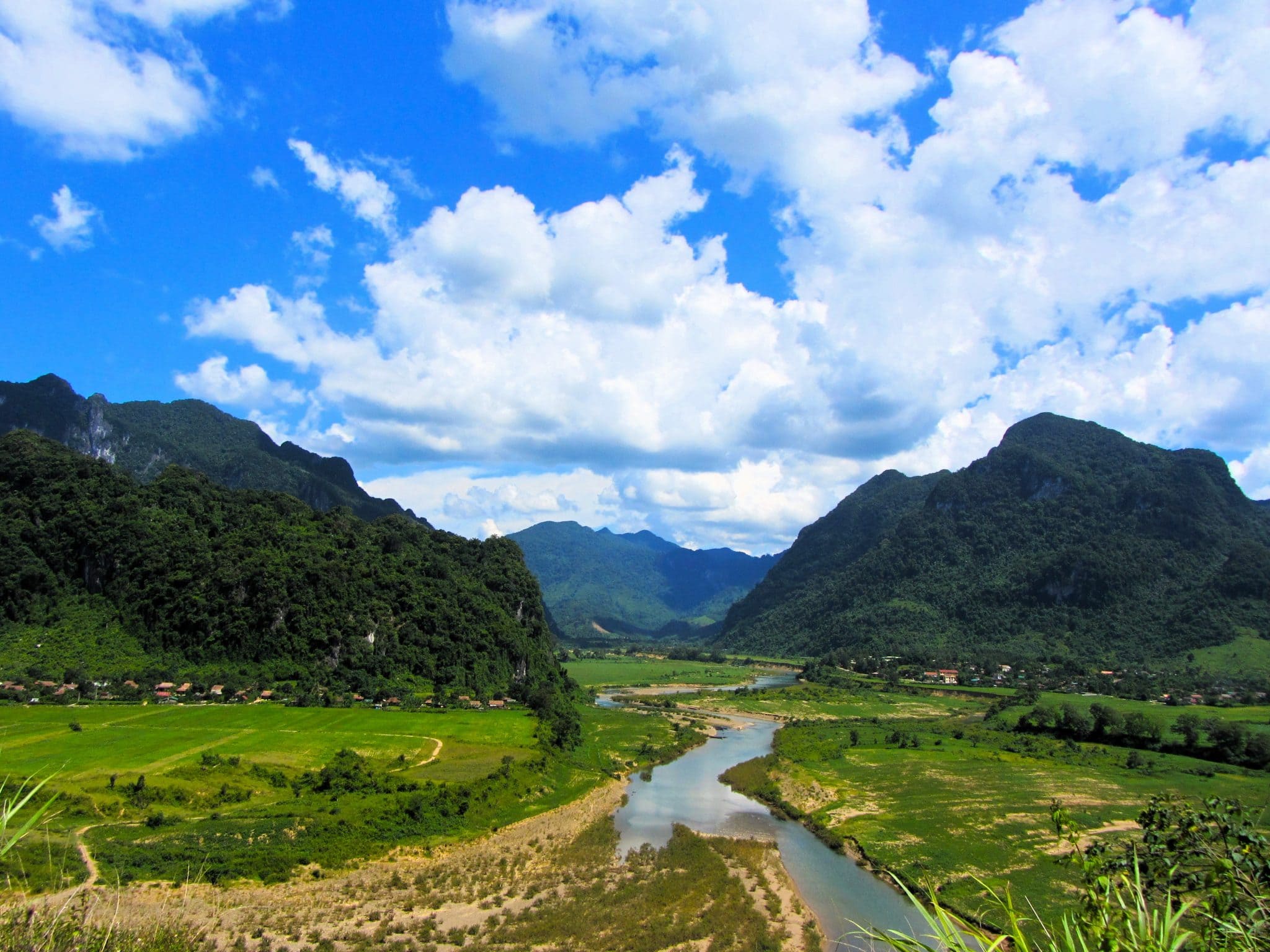
Following the course of the Đăk Pô Kô River north to the village of Đăk Glei, the Ho Chi Minh Road meanders along an agricultural valley where the forests have been decimated in recent years: it looks as though the trees have been vacuumed off the hillsides. However, north of Đăk Glei, the road begins to climb up Lò Xo Pass where the jungles close in and the road soars steeply around the foothills of Ngọc Linh (2,598m), the highest mountain in all of central and southern Vietnam. At the top of the pass, the scenery gets even better as agriculture is pushed from the mountainsides down to the river valleys, forced there by dense tropical forests that appear to melt over the mountains like candle-wax, dripping down the steep contours and washed by relentless cascades of rain-water, draining off the mountains in gushing waterfalls, and swelling the rivers below. A joyous ride along a cinnamon-scented valley leads to the friendly little village of Khâm Đức. A sleepy, likeable place surrounded by purple mountains and fresh highlands air, Khâm Đức has a couple of small hotels for an overnight stay.
The stretch of road from Khâm Đức to Thạnh Mỹ – following a wide and rocky river valley carving through the mountains and jungle – is an excellent ride. Gold was discovered here some years ago, and even today you may see people standing waist-deep in the eddies, panning for the precious metal. Thạnh Mỹ is a strange, dull place at a large crossroads of waterways. Pass straight through it, across the river, and continue due north on the Ho Chi Minh Road towards Prao. This 40km stretch is great fun to ride. Rolling up and down steep slopes and meandering from valley to valley in a glorious slalom, a hypnotic rhythm is induced by the constant switch-backs – lean left, lean right – and the flashes of sunlight piercing through the thick foliage and streaking the road at regular intervals. Eventually, the road drops into a valley and the village of Prao, also called Đông Giang. Here, there are a couple of decent guest houses to stay the night, as well as rice and noodle eateries, cafes and a gas station, where you will need to fill up because there’s very little else for the next 100km to A Lưới.
 Abandoned US airstrip near Đắk Tô
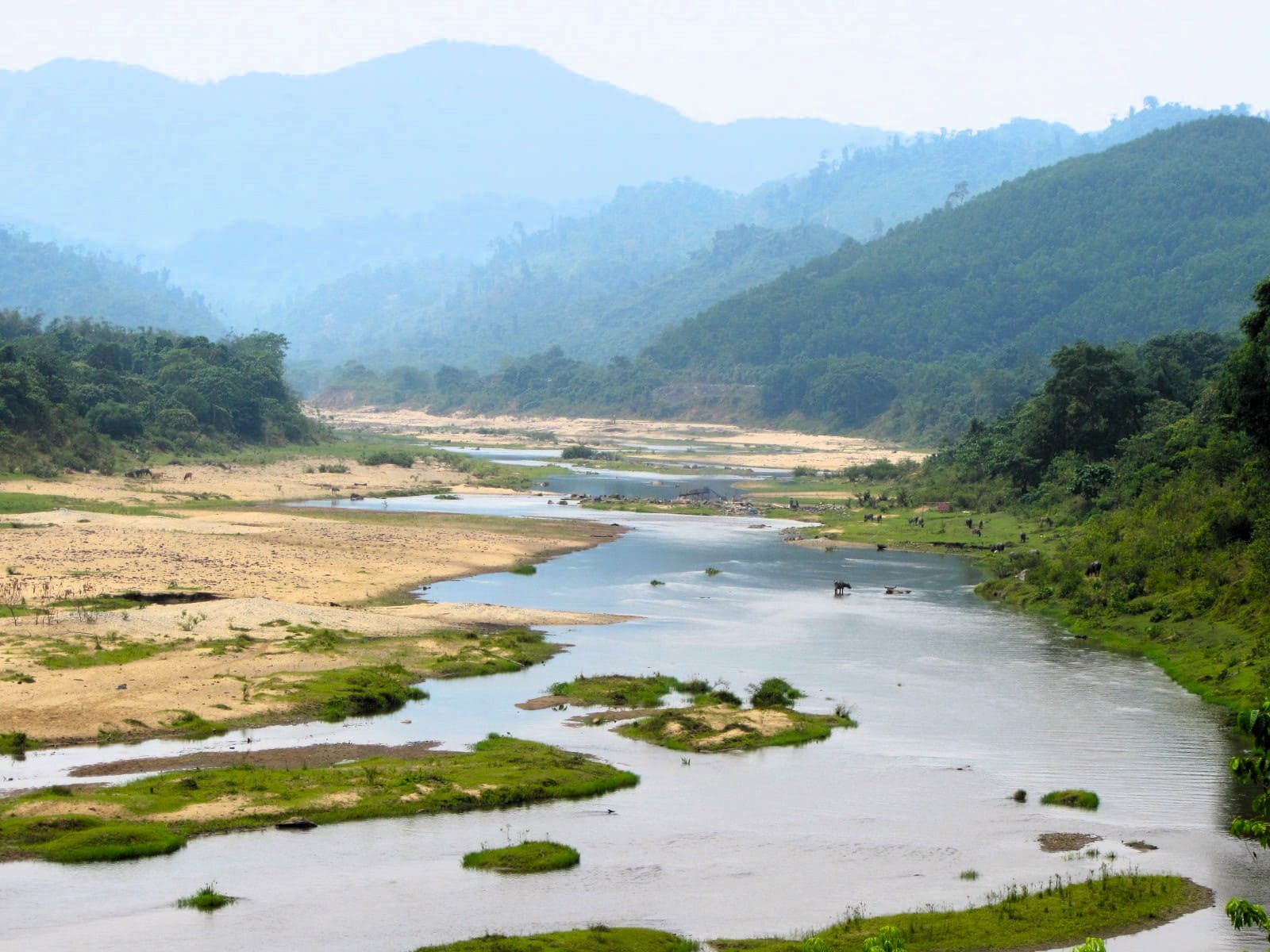

Section 4:
Prao→A Lưới→Khe Sanh | 210km
[View Map]
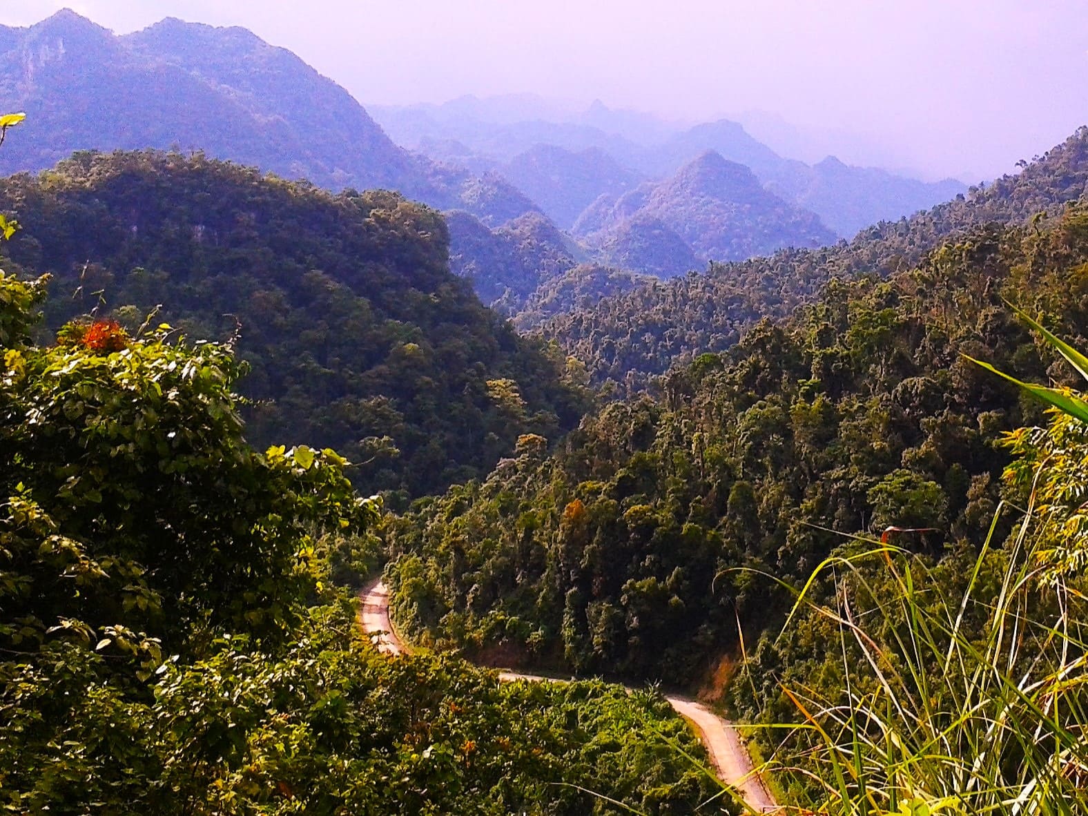
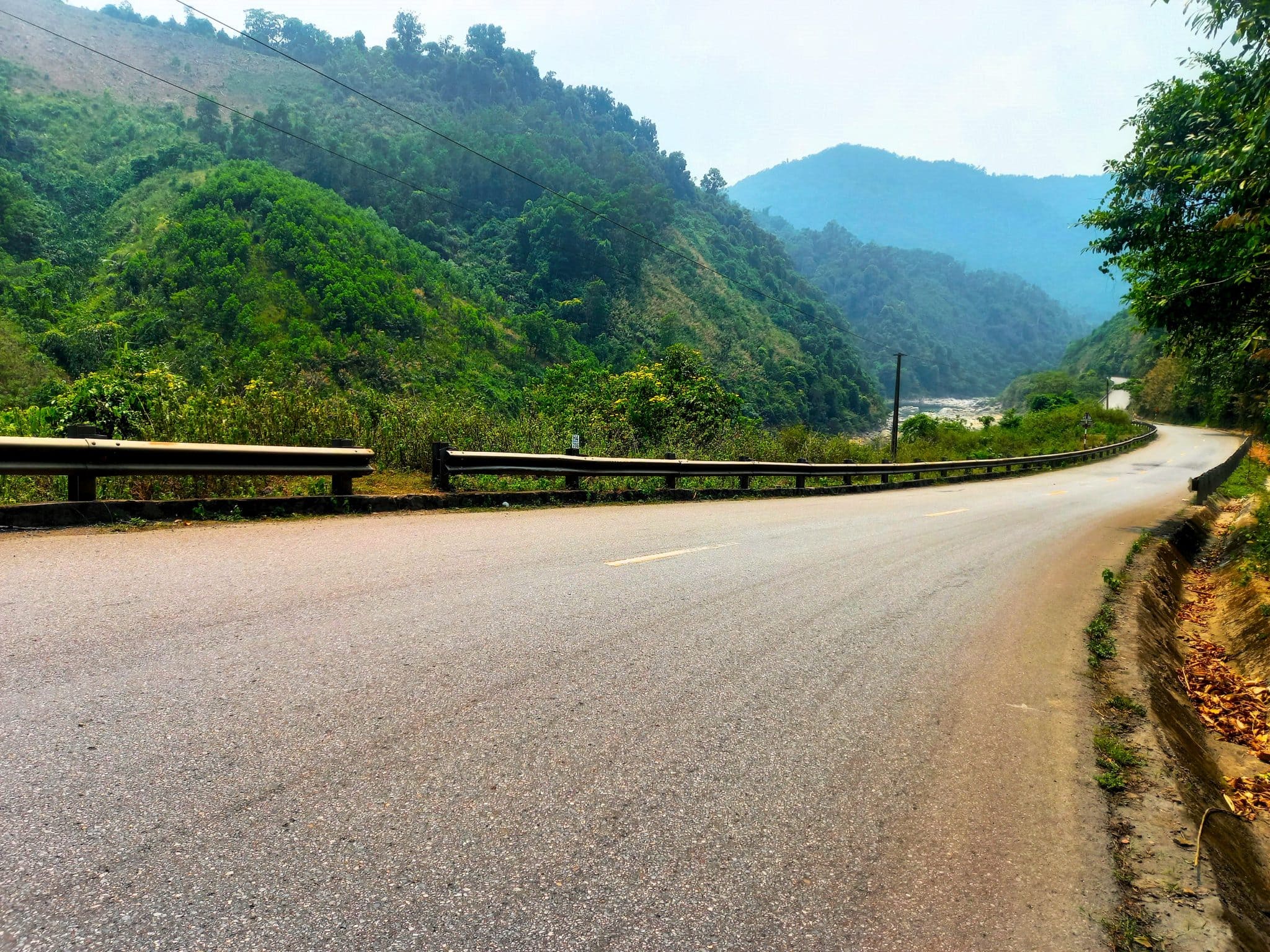
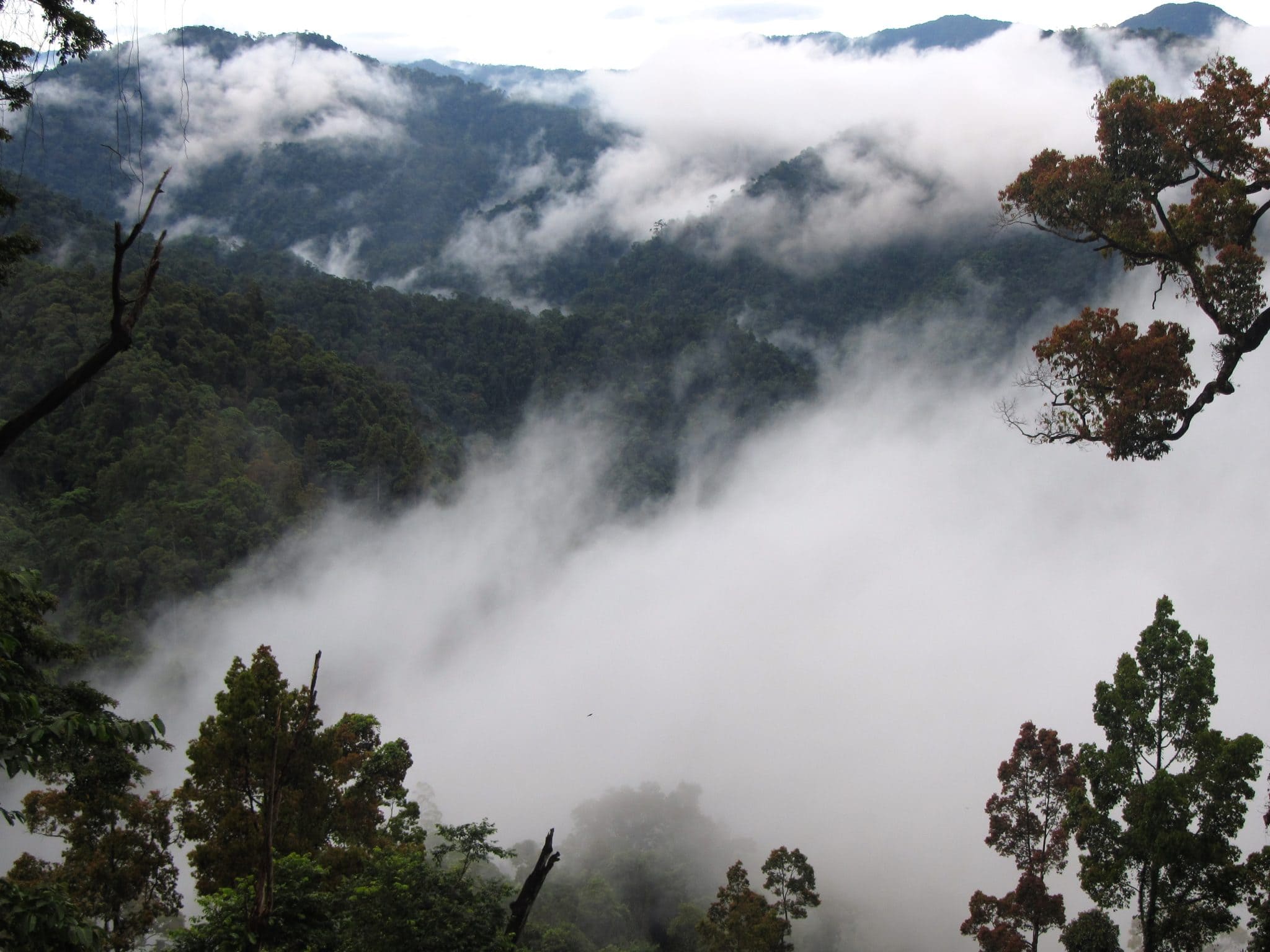
One of the emptiest and most jungle-covered stretches of the Ho Chi Minh Road, the century of kilometers between Prao to A Lưới is a rider’s paradise. You’re unlikely to see more than a few other vehicles on the entire section as you corkscrew up and then spiral down the rainforest-clad mountains straddling the Lao border. The air is fresh, clean, clear and sweet, filled with birdsong and the rush of streams and waterfalls. Ridge after ridge of mountains, carpeted in thick forest, appear to wax and wane behind curtains of cloud, mist and rain. At times, when the road can go no higher, it simply glides along the mountain ridge; when the slope is too sheer for the road to continue, eerie dark tunnels burrow beneath the mountaintops to the other side. There are very few man-made structures in the landscape, save for a remote abandoned army outpost near the Lao border and a couple of forestry huts dedicated to the protection of the rare and endangered Sao La. Also known as the ‘Asian Unicorn’, this pretty, deer-like animal wasn’t even known to science until the 1990s, and it has still never been seen in the wild by a Westerner. Very few are left, but those that are live deep in these forests.
The land levels out as the road glides across a wide agricultural valley to A Lưới, a very friendly little settlement strung along either side of the Ho Chi Minh Road. There’s a large local market, some street food and a couple of OK guesthouses for a night or homestays around the nearby Anor Waterfall.
The next 100km to Khe Sanh is a very pretty ride through an area that was once a major conflict zone. Quảng Trị Province is the most heavily bombed in all Vietnam. Even today, it’s estimated that 80% of land is still affected by UXO (unexploded ordnance). From A Lứơi, the road leads through a wide valley covered in tropical trees – papaya, banana, cinnamon, pineapple, teak. Mountains rise in all directions and local children wave their arms in excitement as you pass through hamlets of wooden stilt houses. You’d never guess that the barren, rounded mountain to the west was the infamous Hamburger Hill. Of course, sites like this make you pause and contemplate the war but, happily, as the road continues up the Pê Kê Pass, along glistening rivers and the jagged Đa Krông valley, it’s the beauty of the landscape and the warmth of local people, rather the tragedy of war, that causes you to stop and reflect.
The last 15km is a steep climb due west to Khe Sanh, a frontier town not far from Lao Bảo, one of Vietnam’s busiest international gateways to Laos. Indeed, the road and town are often full of trucks and buses bound for Vientiane, the Lao capital. Khe Sanh is a dusty market town surrounded by windfarms and the Tà Cơn airbase, site of the infamous siege of Khe Sanh in 1968. The town, which has a couple of decent hotels (Khánh Phương Luxury is by far the best) and places to eat, is a logical overnight stop before tackling the remote and magnificent Western Ho Chi Minh Road the next day. Khe Sanh is at the right altitude and has the right climate to grow the coveted arabica coffee bean. There are several good cafes to sample the local coffee, which is among the best in Vietnam. Get some rest and stock up on supplies (especially gas for your motorbike) in preparation for the next day’s ride into the wonderland that is the Western Ho Chi Minh Road (see Section 5).

Khe Sanh→Long Sơn→Phong Nha | 230km
[View Map]
The 230km/240km stretch from Khe Sanh to Phong Nha/Khe Gát is known as the Western Ho Chi Minh Road and it is unquestionably one of the best rides in Vietnam. The scenery is terrific but riders should take note that there are only a couple of gas stations and accommodation options along the entire route and there are very few settlements, people or vehicles.
I’ve mapped the only two gas stations (one in Hướng Phùng, the other in Long Sơn) on my map. However, both gas stations are sometimes closed or run out of supplies, so it’s a good idea to carry a 1.5 litre plastic bottle of petrol with you in case of emergencies. It’s also worth buying some snacks and drinks for the journey, as there’s precious little in the way of dining options for over 200km. With the opening of a new hotel in Long Sơn – roughly halfway between Khe Sanh and Phong Nha – it’s now possible to ride the Western Ho Chi Minh Road over two days, which gives you all the time you need to take it slowly and really appreciate this remarkable ride. The alternative is to ride the full distance in one day, which means starting early in the morning, because 240km is a long way on such windy roads and your average speed will likely be just 30km-40km per hour. (See the following guide for more details: The Hotel & Gas on the Western Ho Chi Minh Road.)
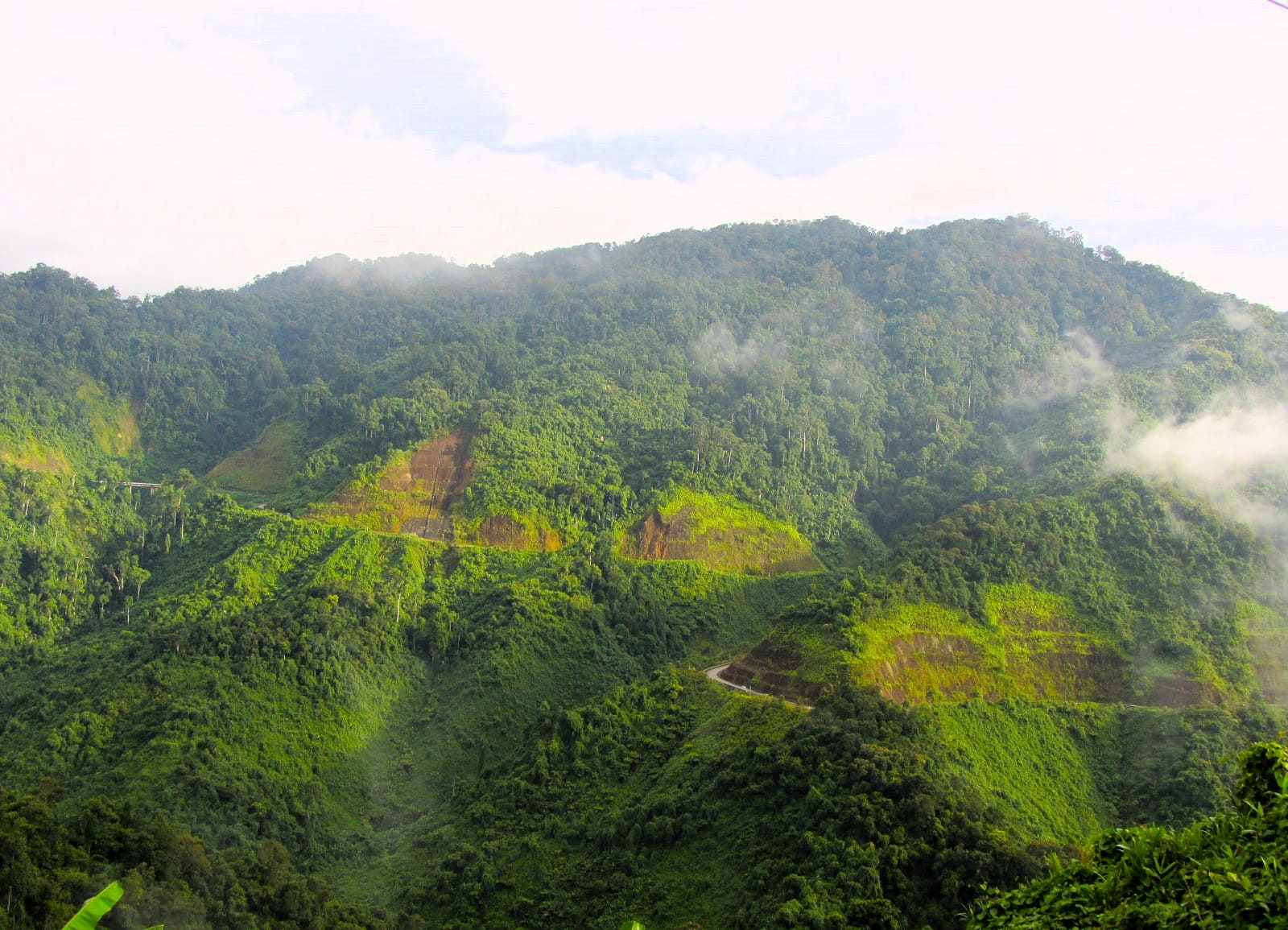
A few kilometres northwest of Khe Sanh, past the Tà Cơn airfield, the road surface changes to the distinctive concrete slabs that characterize the rest of the Western Ho Chi Minh Road. Rolling across an undulating agricultural landscape – planted with colossal wind turbines – the road drops into the dusty village of Hướng Phùng, where there’s a gas station, shops, cafes and a couple of overnight options. Immediately out of town, the road starts to climb the Sa Mù Pass and things get really, really good. Jungles engorge mountain streams that run clean and clear through rifts in the foliage, the road soars, and people and buildings disappear from the landscape. The road swirls down to a crossroads for a remote Lao border gate before beginning another extraordinary ascent into the jungles and mountains, and through remote villages of wooden homes where everyone runs into the road to wave hello, as if they’ve been waiting there all day for you to pass. It just gets better and better, the further and further you go. From here all the way to Phong Nha or Khe Gát, it’s just a matter of letting the scenery wash over you: bend after bend, pass after pass, the landscape folds you in its peaks and valleys, rivers and forests.
After passing the potential overnight stop of Son Homestay and through the rustic hamlet of Tăng Ký, the road runs alongside the Long Đại River, a bucolic valley that, in good weather conditions, is a seam of turquoise running between jade-green limestone hills illuminated by the fresh Trường Sơn mountain light with its distinctive purple glaze. As the scenery reaches its prettiest, the village of Long Sơn appears by a meander in the river. With a gas station, a decent hotel and some shops, this spectacularly located little settlement is the ideal (and the only) place to break your journey on the Western Ho Chi Minh Road. Given the chance, I’d highly recommend staying at the Trường Thành Hotel for a night before continuing to Phong Nha or Khe Gát the next day.
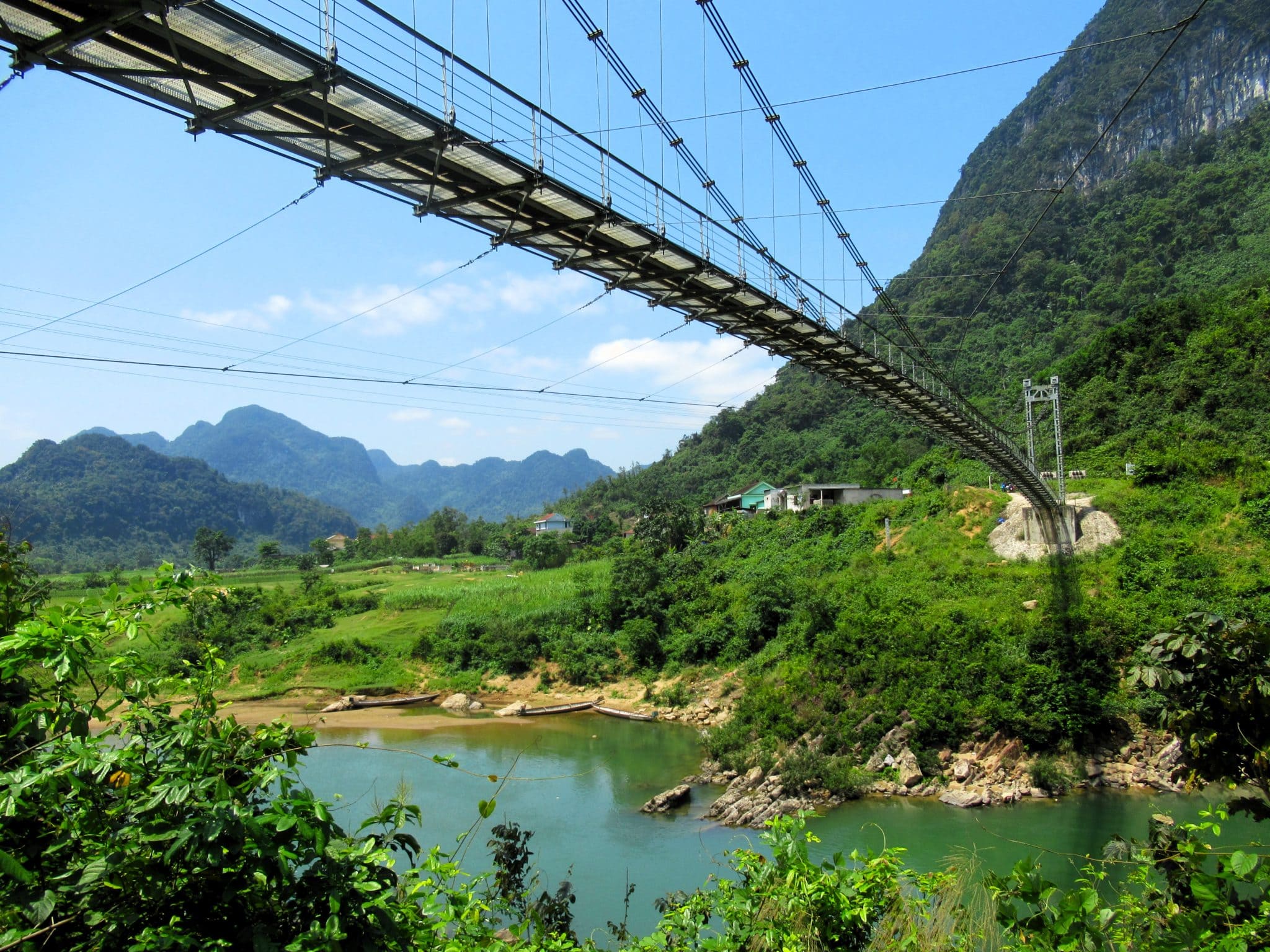
Continuing due north from Long Sơn there is a wonderful, iconic vista back across the valley and the village. Just a couple of minutes further on, don’t miss the picturesque suspension bridge high above the Long Đại River, which is a great photo opportunity and, if you scramble down to the riverbank, an excellent swimming spot. After many hours and much fabulous scenery on the Western Ho Chi Minh Road, you’d be forgiven for thinking that it can’t get any better: but it does. Once the road enters the confines of Phong Nha-Kẻ Bàng National Park, the strange, haunting shapes of jungle-clad limestone mountains come into view. Eroded by the elements over millions of years, these mountains have been sculpted by nature into soaring pillars and pinnacles, many of them resembling the crooked pointy peaks of wizards’ and witches’ hats. For 100km kilometers, the road threads a course between these magical natural edifices. It is a breathtaking ride, and what’s more there is nobody else around. Enjoy it, because the word is bound to get out.
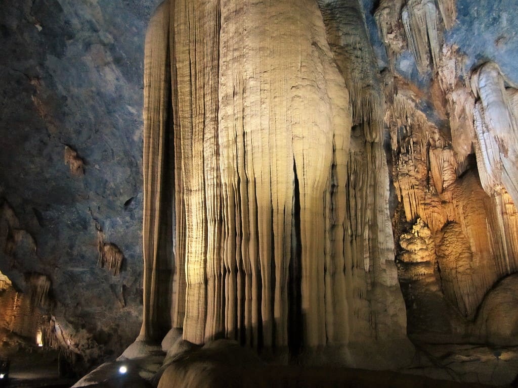
In such a remote and geologically fascinating place as this, it is perhaps not surprising that the region was holding a very big secret. It turns out that the marvels of this national park continue under the mountains. In 2009, it was announced that the largest cave in the world, Sơn Đoòng, had been discovered here. Not only that, but the area is full of impressive caverns, many of which can be easily accessed from the Western Ho Chi Minh Road, such as Paradise Cave, Dark Cave, and Phong Nha Cave, and others that can be visited via multi-day expeditions with professional tour companies in Phong Nha. These are all wonderful places to visit, but try to come on a weekday (not a weekend or holiday) when the caves are less crowded.
At an intersection, riders have a choice: bear left (due northwest) to stay on the Ho Chi Minh Road to Khe Gát (20km), or bear right (due northeast) to continue to Phong Nha village (15km). Phong Nha is a good place to overnight and do some some sightseeing. There are lots of good accommodation options and the area is a travellers enclave, with trendy cafes, international cuisine and a lively atmosphere. A day or two here to rest and relax makes sense before rejoining the Ho Chi Minh Road again.


Section 6:
Phong Nha→Hương Khê→Phố Châu | 180km
[View Map]
Leaving Phong Nha and Khe Gát junction behind, the Ho Chi Minh Road bears due northwest, starting with a long, straight section of road running beneath a line of limestone mountains, following the course of a war-era military airstrip. This gives way to the steep and wide Đá Đẽo Pass, which curls around the mountains offering Jurassic Park-like views across a lush landscape of jungles and karsts. Beyond the pass, the road ploughs on alongside blue rivers bisecting verdant valleys between vertical limestone pillars and wooden hamlets clustered on the narrow plains. Traffic is very light and the scenery is excellent for the entire 100km stretch between Phong Nha and the junction at Tân Ấp. If you have time, there are several small paved lanes leading off the highway to some wonderful swimming spots on the river.
After Tân Ấp, the scenery becomes much gentler: the valleys are wide and cultivated, the road is straight, the mountains recede into the distance and traffic gets heavier thanks to trucks plying between Lao border gates in the west. Trade with Laos is booming and this means that transportation corridors linking the two communist nations are blighted by freighters crawling along the roads. Still, the riding is pleasant and swift, road conditions are good and the landscape is big and green if not spectacular. Hương Khê is a surprisingly lively settlement with a large lake and some decent food and accommodation if needed.
Although the last leg to Phố Châu passes some good scenery – rubber, tea and cinnamon plantations and the misty, forested slopes of Vũ Quang National Park to the west – when compared to the dramatic landscapes of the previous days, it seems tame and tainted. Settlements get bigger, concrete houses replace wooden huts, agriculture swallows up the forests and factories appear by the roadside. Phố Châu is a crossroads town at an intersection with Highway QL8A, which leads west to the Cầu Treo border crossing with Laos. There’s not much to recommend Phố Châu, but it’s a natural overnight stop on the Ho Chi Minh Road with some hotels and dining options.
 The Ho Chi Minh Road near Phong Nha


Section 7:
Phố Châu→Tân Kỳ→Cẩm Thủy | 260km
[View Map]
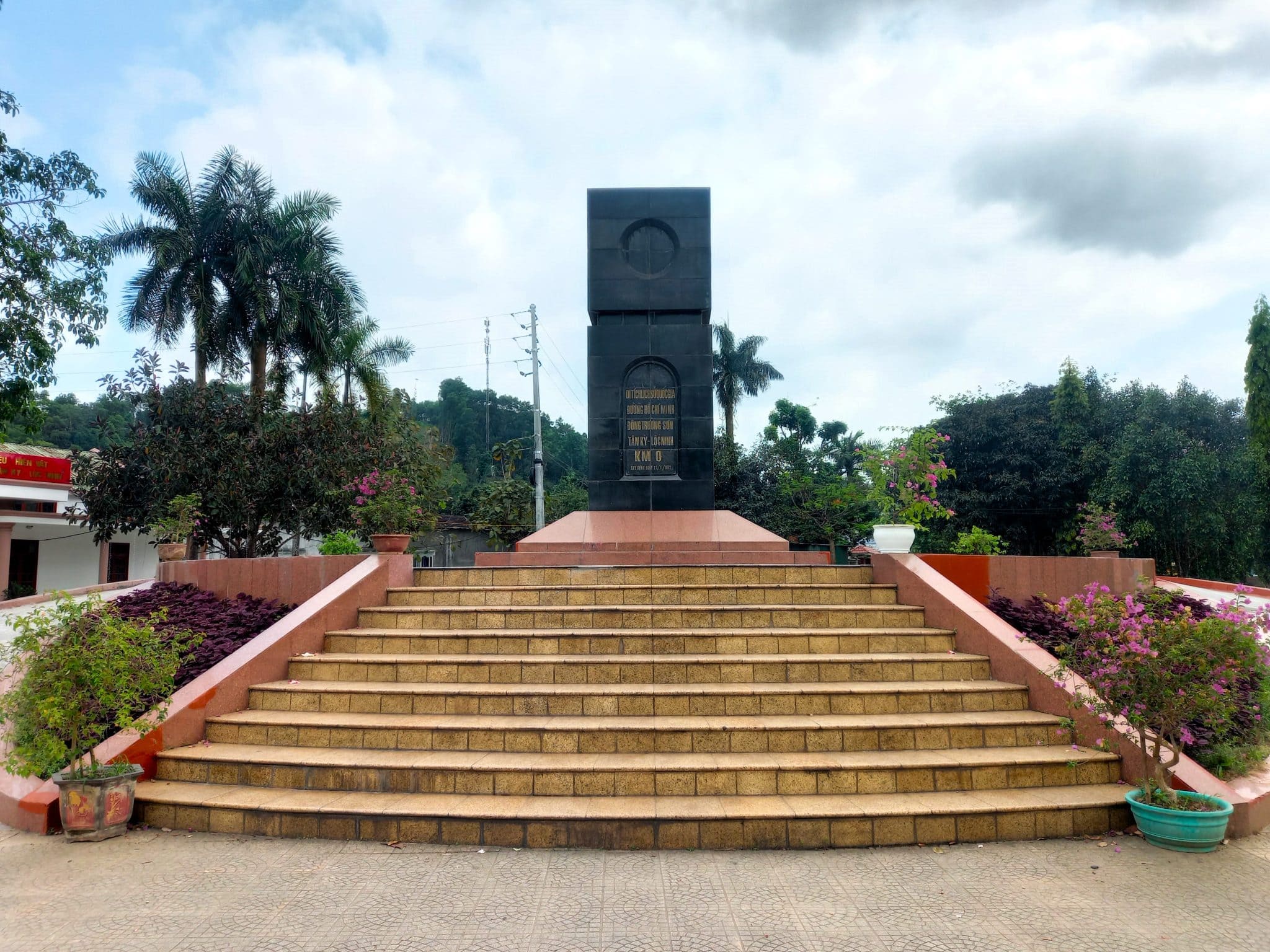
An open, largely empty stretch of road coursing through a landscape of plantations covering the length of Vietnam’s largest province (Nghệ An), the section of the Ho Chi Minh Road between Phố Châu and Tân Kỳ is characterized by gentle hills, terraced tea farms, pine forests and the high misty mountains of Laos to the west. It’s a pleasant, easy and uneventful ride with a few points of interest and worthwhile detours, if you have the time. Thanh Chương lies west of the road, where boats take visitors on a lake surrounded by pretty tea hills and several homestays offer overnight accommodation. Khe Kèm Waterfall is an hour west of the Ho Chi Minh Road, and Kim Liên, the birthplace of the road’s namesake, is a short ride east. What’s more, at Tân Kỳ the KM0 Monument marks the start of the original Ho Chi Minh Trail where supply lines stretched all the way south, through the jungles and over the mountains via Laos, to aid fighting in the south of Vietnam. Tân Kỳ also has some decent accommodation if you need it. If you’re feeling adventurous (and can spare a couple of days), the empty roads and amazing landscapes of the Mường Lống Loop lie further to the west.
At the ‘neck’ of Vietnam, Nghệ An is a vast province and the revolutionary heartland of the nation; many of the country’s most celebrated heroes hail from this region. People here are known as ‘Nghệ An Buffaloes’ on account of their resilience and hardiness to endure the labour involved in working the land and the harsh climate they face throughout the year: massive heat and typhoons in the summer; cold, bleak days in the winter. However, when riding through the province on the Ho Chi Minh Road, its an easy, smooth drive all the way due north to Lam Sơn, a sprawling network of settlements and home to one of Vietnam’s greatest military figures, Lê Lợi (1385-1433), whose temple and tomb can be visited just east of the road at Lam Kinh. There’s some accommodation in and around Lam Sơn, if needed, and this is also the start point of another excellent off-the-beaten-path motorbike route, the Lam Sơn Loop.
Although the land is still rural and cultivated with acres of corn and sugarcane, traffic and industry begin to encroach as the Ho Chi Minh Road ploughs north from Lam Sơn towards Ngọc Lặc and Cẩm Thủy. These two small towns are fine for a night and surrounded by limestone karst mountains, bamboo forests and pretty streams which hint at the magical scenery that lies west of here on the Limestone Loop and in Pù Luông Nature Reserve, which make a great detour, if you have time. If not, bed down and get some rest before the next – and final – leg of the Ho Chi Minh Road.


Section 8:
Cẩm Thủy→Cúc Phương→Hanoi | 150km
[View Map]
Although the limestone scenery, including forest-covered karst pillars rising from the rice paddies cloaked in mist, continues along the Ho Chi Minh Road for most of the final 150km from Cẩm Thủy to the outskirts of Hanoi, it is spoiled somewhat by the steady increase in truck traffic and pollution from the numerous quarries and cement plants along the highway. Just north of Cẩm Thủy, an interesting detour is due southeast to Thành Nhà Hồ, the impressive remains of an ancient citadel dating from the early 15th century. Otherwise, continuing north on the Ho Chi Minh Road, it’s not long before the asphalt soars on an elevated platform through the jungles of Cúc Phương, declared Vietnam’s first national park by Ho Chi Minh himself, in 1962. The road follows the course of the turquoise Bưởi River as it swerves between rocky peaks. For a break, take the small lane due west along a pretty tributary to Thác Mây (Cloud Waterfall), where there are some good bathing pools and a cluster of homestays.
The procession of limestone hills continues on both sides of the road as the route heads further north, getting closer to journey’s end at the capital. The road surface is generally good and the riding is fine, but you won’t want to spend too much time lingering over this section, because the dust kicked up by passing trucks is unpleasant and the air quality is increasingly poor the closer you get to Hanoi. The last 50km to Xuân Mai and Hòa Lạc can be a very nasty and dirty ride indeed. Turn off the Ho Chi Minh Road at the big intersection at Hòa Lạc and head east on the wide Thăng Long Highway leading straight into the heart of the capital city. If the ride through the industrial suburbs left you feeling depressed, the sight of central Hanoi with its considerable charm is certain to lift your spirits.

Source of the article: Vietnam Coracle