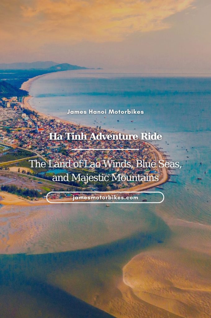
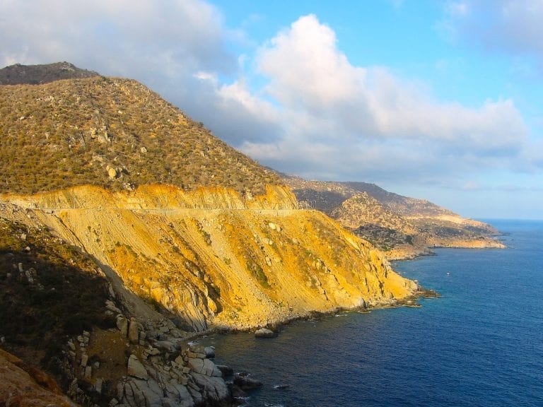
A rugged, sandy, boulder-strewn promontory separates the fishing village of Cà Ná and the beach town of Phan Rang, on Vietnam’s south-central coast. The landscape is striking, arid and deserted: dominated by wind-swept sand dunes, prickly cacti, rocky mountains and wild beaches. People say this is where dragons came to die and the earth scorched itself in grief. Opened just a few years ago, a stunning new coast road negotiates the rocky, desert-like terrain, chiseling a course along the cliffside high above the sea. Marked on maps as Đường Ven Biển Ninh Thuận (Ninh Thuan Coastal Route), this road stretches some 40km along a spectacular and previously inaccessible coastline. Easily one of the best coastal rides in Vietnam, I like to think of this route as the Dragons’ Graveyard Coast Road.
GUIDE: DRAGONS’ GRAVEYARD COAST ROAD
The Dramatic Coastal Route from Cà Ná to Phan Rang
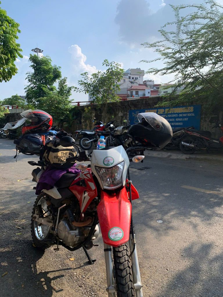
In this guide, I’ve written a description of the Dragons’ Graveyard Coast Road from Cà Ná to Phan Rang, including a route map and suggestions of places to see, stay and eat along the way. The total distance is only 50km. You can ride this route in either direction as a day trip or as part of a longer, multi-day road trip. If riding as a day trip, you should be able to find motorbikes for daily rental by inquiring at your accommodation in Phan Rang or Cà Ná. However, the Dragons’ Graveyard is best experienced as part of a longer coastal road trip by linking with the Sand Dune Highway (to the south) and the Núi Chúa Coast Road (to the north), thus creating the most scenic coastal route in Vietnam. The weather is good pretty much year-round as this is one of the driest regions in the country. However, to see the Dragon’s Graveyard at its arid, burnt-out best, go during the height of the dry season (January to April).

Map:
Dragons’ Graveyard: Cà Ná to Phan Rang Coast Road
The Route:
DETAILS:
- Route: Cà Ná to Phan Rang via the dramatic coastal route
- Distance: 50km
- Duration: 2 hours-1 day
- Scenery: beaches, salt fields, sand dunes, desert, wind farms, cliffs, fishing villages
- Attractions: spectacular cliffside views, empty beaches, swimming, hiking, great riding
- Road Conditions: good, smooth, paved roads, light traffic (rockslides possible)
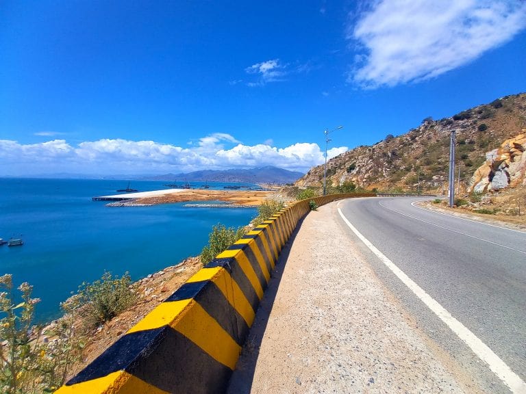
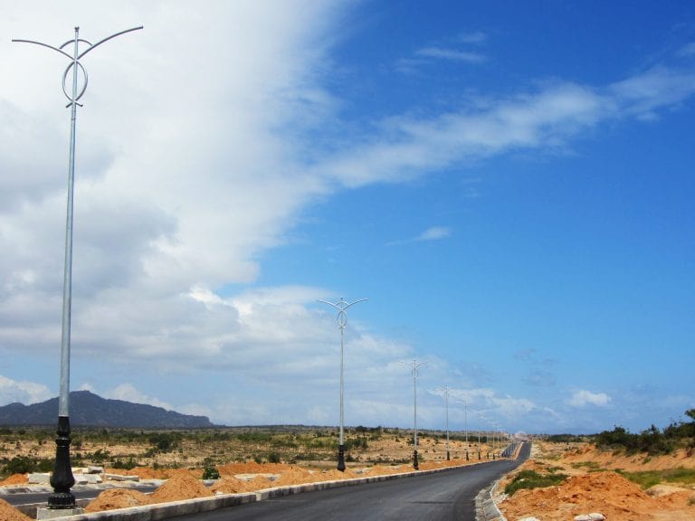
Leave the white, coral-bleached bay of Cà Ná by way of Highway QL1A as it bends due north past fish sauce factories; the aroma of their produce heavy in the air. After just a couple of minutes, bear right, heading due east: this is the start of the Dragons’ Graveyard Coast Road, marked on maps as Đường Ven Biển Ninh Thuận (Ninh Thuan Coastal Route). Only completed a few years ago, the road starts out flat, wide and straight: a raised dyke gliding over large salt fields with white mounds of salt piled high in the baking sun and the rock-strewn mountains rising in the distance. Cà Ná fishing village sprawls along the seafront, with its large fleet of wooden, wide-hulled ships lying at anchor in the harbour. This first stretch of road is highly exposed, making it a very windy and hot few kilometres. When the asphalt meets the ocean, it’s tempting to stop for a swim in the glistening seas. Unfortunately, a big new container port is now under construction here, which makes finding a good swimming hole a bit of a challenge.
After the port, the road ascends steeply, winding up the rocky headland with the sea far below. But don’t forget to stop and look back at the impressive vista unfurling behind you to the west: you’ll see the whole coastline, from Cà Ná to Liên Hương to Mũi Né (all part of the Sand Dune Highway route), receding into the distance (although the view is somewhat spoiled by the enormous silhouettes of Vĩnh Tân power station). A big lay-by provides a good viewing point, especially at dusk, when the sun sets over this coastal scene. But don’t linger too long, because things are just about to get even better: the next 15km is the most spectacular section of the route.
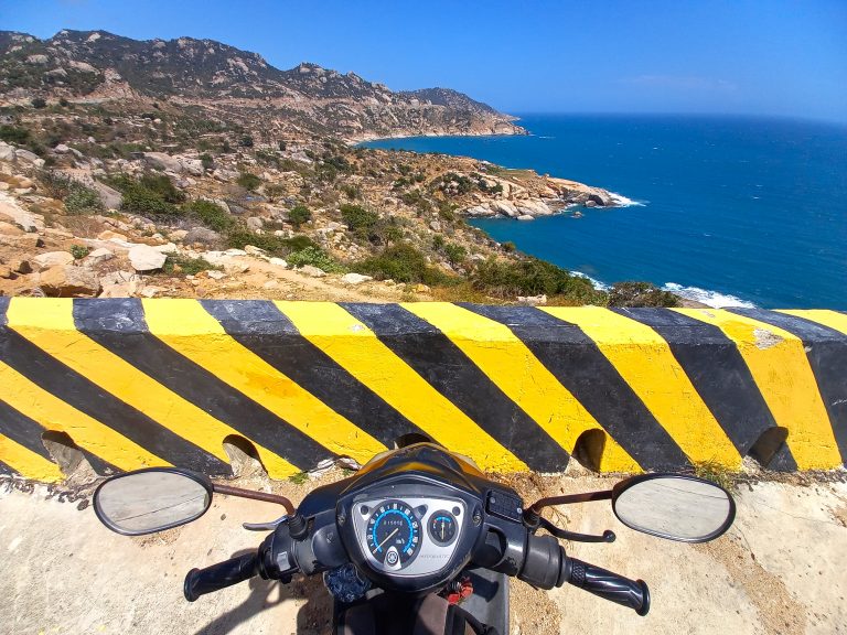
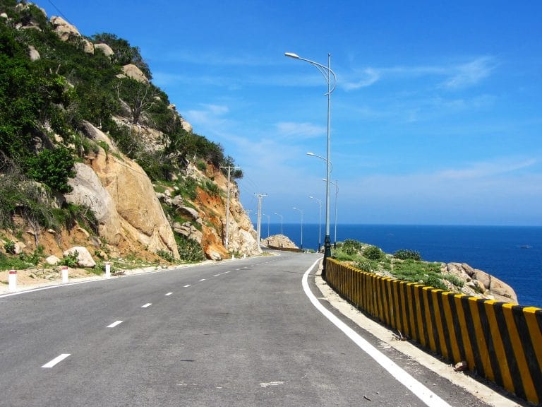
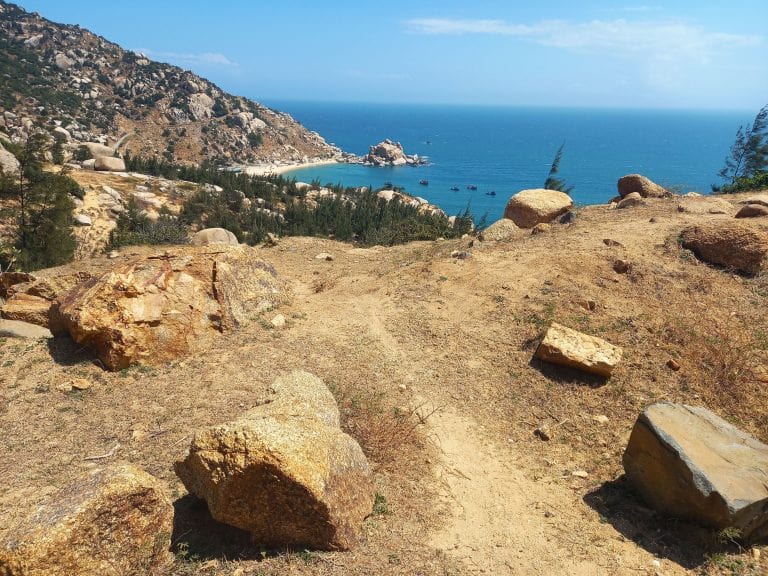
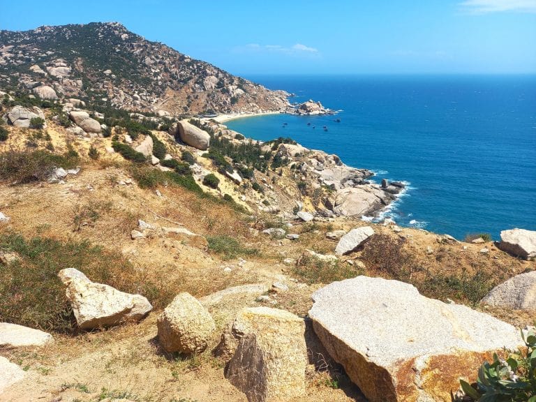
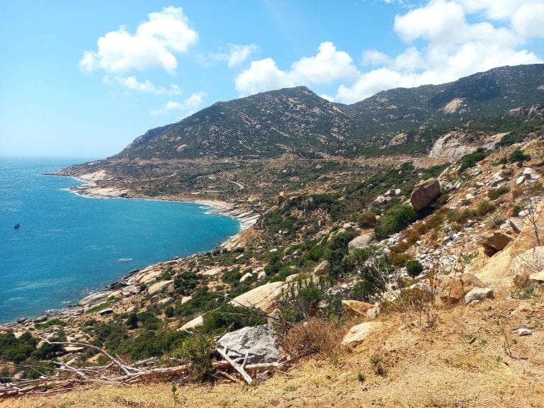
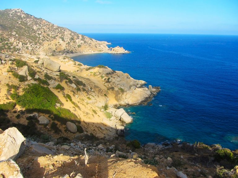
From this, the most southerly point of the route, the road begins to crawl around the edge of a big, rugged promontory known as Mũi Dinh, cutting high passes above boulder-strewn precipices, with the amethyst-coloured sea hundreds of feet below. Despite the dramatic scenery, this new coastal highway is almost completely empty as it clings to the cliffside. The sandy, rocky, cacti-studded headland is a rich, toast-gold in the burning bright sunshine of Ninh Thuận, the driest province in Vietnam. The scenery is reminiscent of Greece or southern Spain rather than Vietnam. Take your time and enjoy this fabulous new stretch of road. (Note: although traffic is very light, this road can be dangerous because of the risk of rockfall from the hillsides. The road surface is pockmarked from where boulders have tumbled down in landslides. Ride carefully.)

There are lots of excellent photo opportunities and places to pull in by the roadside to admire the impressive views. There’s very little development on the coast here yet, although surely it’s just a matter of time. For now, most of this rugged promontory remains untouched. But there are a handful of small shacks selling drinks, snacks and seafood, most of which are perched on the hillside halfway down between the road and the sea. A couple of them now have extremely steep concrete lanes leading down to them; others have footpaths. It’s worth stopping at one: if not to eat, then to get down to the ocean for a swim in the gin-clear water.
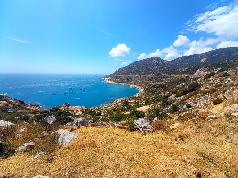
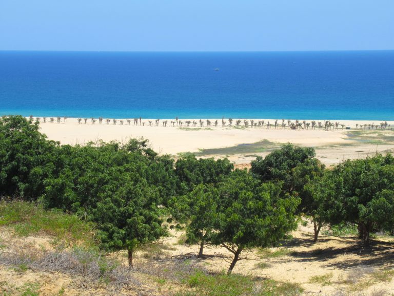
As the road veers northwards, there are several arresting views down to the crescent-shaped beach of Bãi Tràng. Isolated, exposed and striking, this bay made my list of the 23 Best Beaches in Southern and Central Vietnam. Rising up behind the beach is a rocky bluff topped with a French colonial-era lighthouse. This is Hải Đăng Mũi Dinh, the most easterly point on the Vietnamese mainland (although Mũi Đôi at the tip of Hòn Gốm Sandbar also claims this title). Not only are these sights (the beach and the lighthouse) both beautiful spots, but they’re also something of a pilgrimage, especially for a generation of young Vietnamese backpackers with a newfound love of domestic travel, who want to have photographic evidence of their travel exploits by taking a selfie at the most easterly (Mũi Dinh), westerly (A Pai Chải), northerly (Lũng Cú) and southerly (Mũi Cà Mau) points of Vietnam.

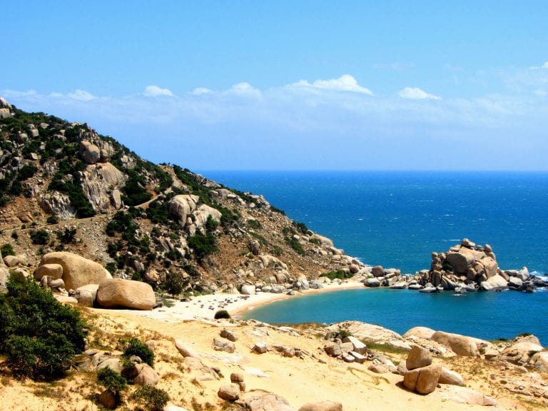
You’re not allowed to drive down to the beach or up to the lighthouse, but you can hike to them from several points. Most people begin the hike (which takes about an hour) from the drinks shacks clustered around a huge, freestanding boulder next to the coast road. It’s a hot and sandy trek, but it’s well worth the effort: swimming on Bãi Tràng beach is wonderful (there are food shacks on the beach, too) and the views from the top of the lighthouse are sensational. (Parking is at the drinks shack by the giant boulders: a small fee may be charged for parking and for the hike.)
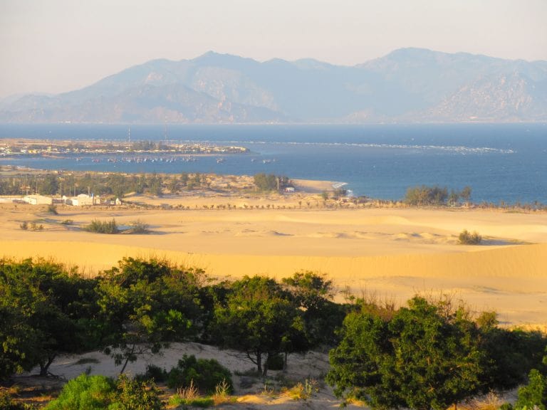
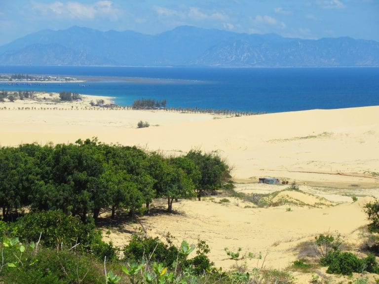
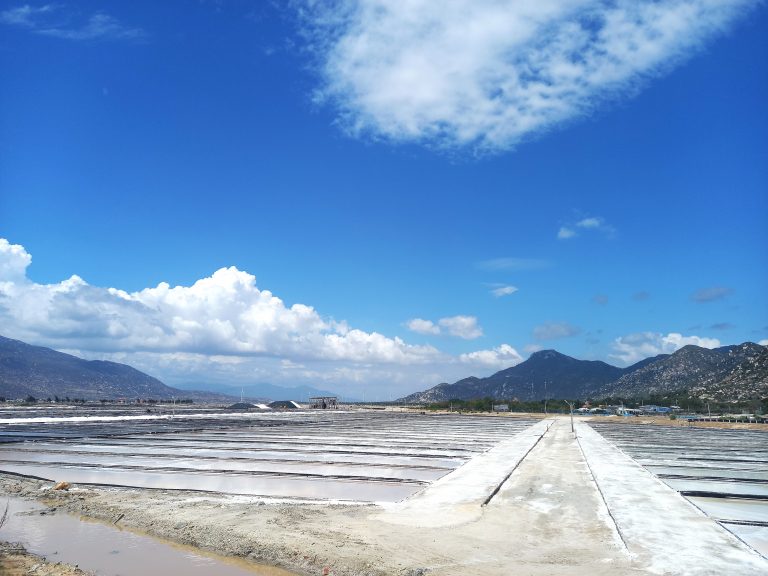
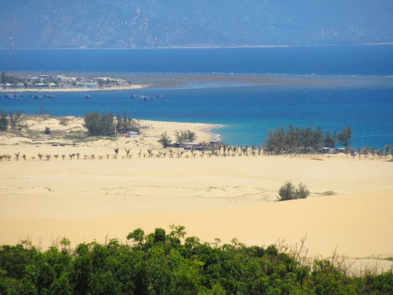
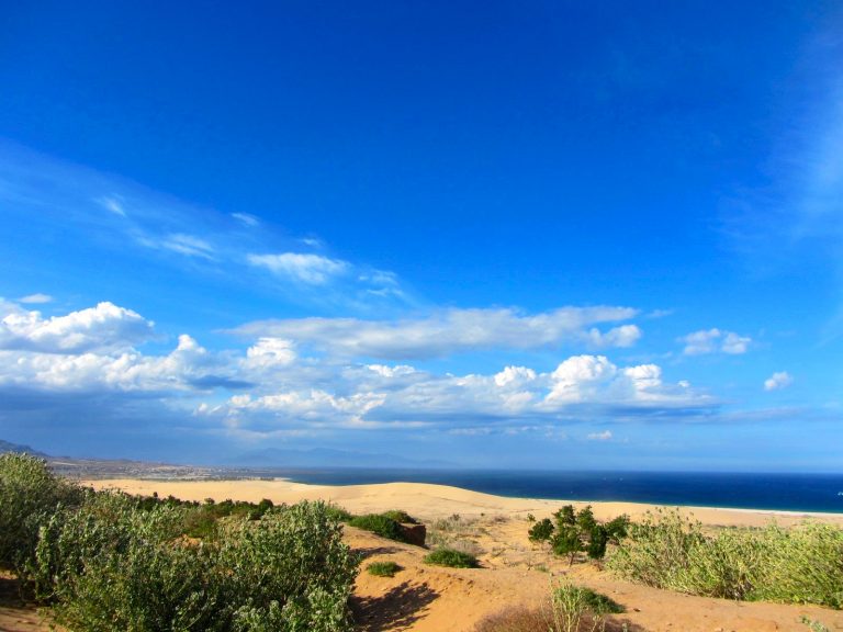
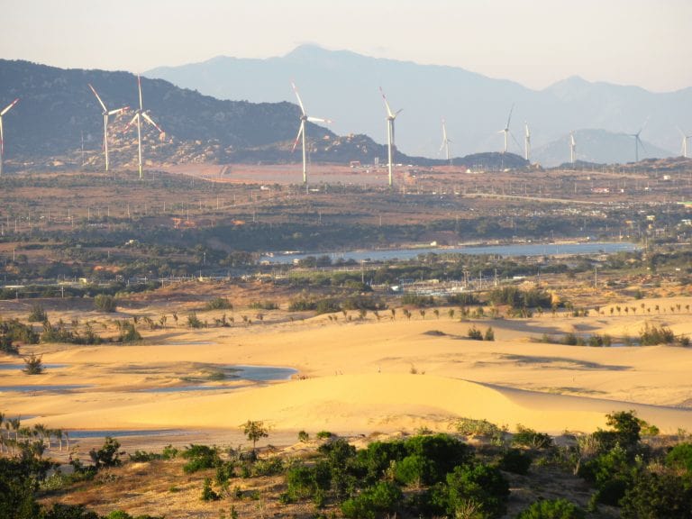
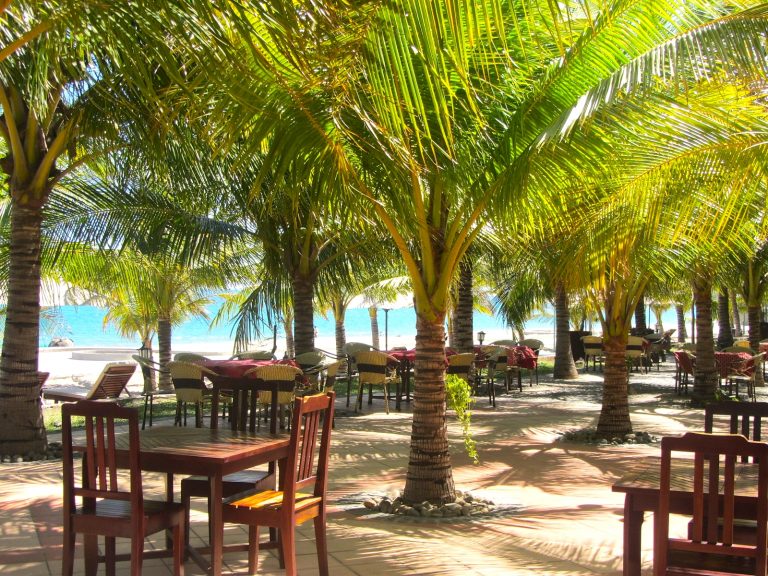
Beyond the lighthouse, the coast road veers inland and the terrain becomes flatter, sandier, drier and ever more desert-like. Huge drifts of white and orange sand form smooth dunes that look like colossal waves. The land broadens, opening onto a wide, arid plain along which goats and sheep graze. As the road soars across the plain, there are some big, sweeping views over the sand dunes and out to sea. To the east, a long, white sand beach is lined with palm trees awaiting imminent construction of a large resort complex. For now, though, the only real tourist infrastructure is the rather unexpected Tanyoli, on the inland side of the road, which is a sort of farmstay-cum-ecopark, offering camping, glamping, outdoor activities and Mongolian-style yurts.

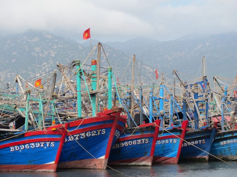
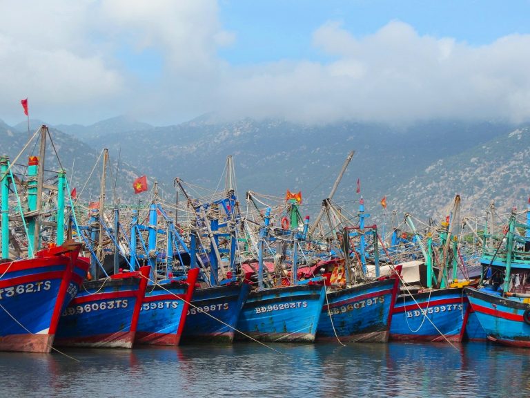
Accessed via a slip road off the main coast road, Sơn Hải is the only settlement of size between Cà Ná and Phan Rang. The fishing village is a dusty, dry little place with a fleet of blue-painted, wooden boats and giant woven coracles clustering in the harbour. It’s a scenic spot for a town and Sơn Hải’s narrow streets are surprisingly full of activity and life, especially around the market and near the seafront. In the late afternoons – as in most Vietnamese coastal villages – there’s a pleasant buzz as kids come out of school and food vendors set up on the roadside. To the west, on the opposite side of the coast road, a giant cemetery graces the sandy hillside, home to many generations of Sơn Hải former inhabitants.

The landscape here is characterized by sand, cacti, boulders, arid mountains and blue seas. It’s a rocky, burned landscape and there’s something magical about it. The intense heat and the bright light reflecting off the boulders, sand and sea give the impression of an ancient and vast land – the kind of place you’d expect to stumble upon a dinosaur skeleton or forgotten temple buried in the sand. The prickly cacti that dot the terrain are known as xương rồng in Vietnamese, which means ‘dragon bones’. People used to believe (perhaps some still do) that this is where dragons came to die: their ‘bones’ littered the earth which then scorched itself in grief, leading to the desert-like landscape you see today. Riding through the giant mounds of boulders and cacti – which appropriately look like tombstones – it’s easy to imagine this place as a dragons’ graveyard.
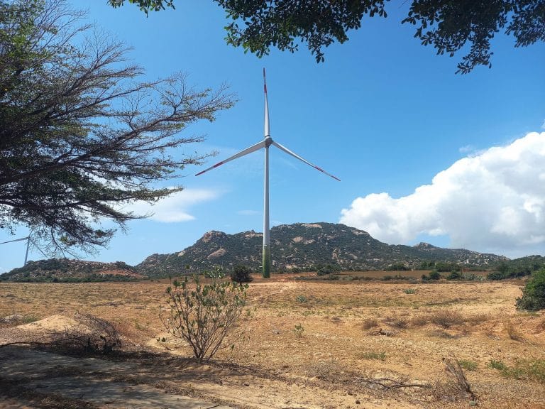
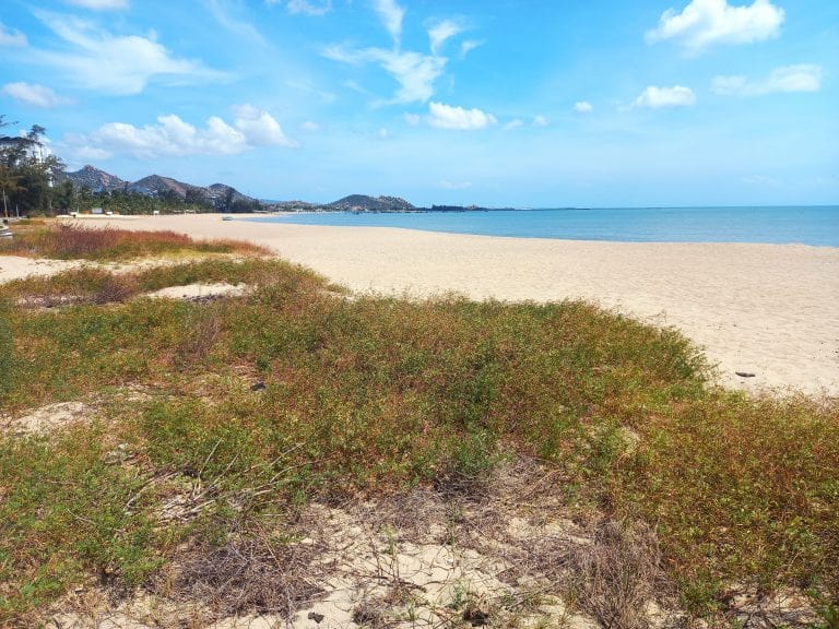
As the road continues due north of Sơn Hải village, the wind picks up and the sun’s heat has an added intensity. It’s no wonder that this is now Vietnam’s renewable energy capital: wind and solar farms blanket the region. The wind turbines, in particular, are a graceful and impressive man-made addition to the landscape, which have become a popular backdrop for social media photos. Also nearby, are the Nam Cương Sand Dunes and Cánh Đồng Rong Biển (seaweed fields), both of which can be easily visited via slip roads. Further north, dozens of large-scale shrimp farms line the coast road all the way to the bridge across the Cái River, the other side of which is Phan Rang city, and the end of the Dragons’ Graveyard Coast Road. Head straight on after the bridge until you meet Yên Ninh street which follows the long bay of Ninh Chữ, a good, sandy beach within striking distance of Phan Rang city and with plenty of accommodation options (see Places to Stay).
Places to Stay:
The best place to stay on the Dragons’ Graveyard Coast Road is Phan Rang, where there is ample accommodation, a good beach and lots of food. However, it’s also possible to overnight at a couple of other places on the route. See below for details and specific recommendations. (All accommodation options are also marked on my map):
Phan Rang: With a decent range of accommodation near the beach and in town, Phan Rang is the obvious place to overnight or base yourself when riding the Dragons’ Graveyard Coast Road. Along the seafront, Yen Ninh street has lots of mid-range resorts and budget mini-hotels to choose from. TTC Resort, Long Thuan Hotel and SaiGon-Ninh Chu Resort are all big properties right on the beach with full facilities for $40 upwards per night. Cheaper hotels are on the non-beach side of the road: a good value option is Ninh Chu Hotel; or very cheap, minimal but thoughtful backpacker-style digs can be found at Cube Homestay. Towards town, Minh Quang is one of a string of mini-hotels; and I like Nu Hoang for cheap, clean accommodation in the centre of town.
Cà Ná: If you need to stay in Cà Ná for a night, the best accommodation is Hon Co-Ca Na Resort, a decent mid-range place to stay with sea views and beach access (around $40/night). Just west of the resort, along the seafront by the highway, there are a handful of other small hotels that are pretty cheap (200,000vnđ upwards) and fine for one night. Mui Dinh Hotel is one such example ($10/night).
Camping: If you have your own tent, the Dragons’ Graveyard route has lots of potentially great campsites. The landscape is big, arid, exposed and sparsely populated. In addition, there are traditional Mongolian-style canvas yurts and small wooden huts to sleep in at Tanyoli Tourist Area (they might even allow you to pitch your tent for a fee if you ask nicely). You can also arrange to camp on Bãi Tràng beach and Mũi Dinh lighthouse overlooking it, but this usually needs to be organized in advance at the trailhead near the big boulders on the road.

Food & Drink:
The Dragons’ Graveyard isn’t a long route and there are places on the roadside selling snacks and drinks along the way, so you won’t go hungry on this short road trip. However, for real meals and great street food, Phan Rang offers the best food on this route.
Seafood: With its long beachfront, seafood is well-represented in Phan Rang. Look for signs saying quán hải sản (seafood restaurant), especially along Yên Ninh, the seafront road near Ninh Chữ beach. In particular, two clusters of informal local seafood restaurants right by the beach can be found here and here. (There are also seafood restaurants along the highway and coast at Cà Ná, but they are a bit too expensive and often full of coach passengers.)
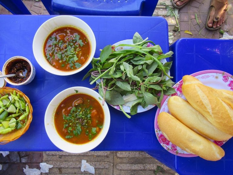
Street Food: For street food, Phan Rang is famous for several dishes: bánh xèo, bánh căn and chả cuốn can be found on almost every street in and around the city. Bánh xèo are the famous savoury Vietnamese ‘crepes’ filled with shrimp and pork, but the Phan Rang variety is much smaller than the Saigon and Mekong Delta versions. In Phan Rang, the tiny bánh xèo are submerged in a sweet nước mắm (fish sauce) with the addition of several varieties of torn up herbs, such as mint, mustard leaf and sweet basil. Bánh căn are served and eaten in a similar fashion, although these are even smaller but thicker and spongier rice flour-based ‘cakes’. Look for signs all over town or try the cluster of competing stalls either side of Trần Anh Tông street. Chả cuốn is a local version of the classic fresh spring roll: rice paper is wrapped around fresh herbs, cold cuts, duck egg and sliced fishcake to create a satisfying and textual snack. The chả cuốn at Bánh Canh Nhường is locally famous, but you can also find chả cuốn all over the city. (There’s also some interesting street food and a local market in Sơn Hải, roughly halfway between Cà Ná and Phan Rang.)
Drinking: Soft drinks, water and local coffee are sold at shacks at fairly regular intervals throughout the route. Phan Rang has a decent cafe scene. Try exploring the streets and blocks north and west of 16/4 Park in the city centre. Phan Rang also has a nascent bar scene, thanks to a small expat community, growing numbers (at least before the pandemic) of Russian tourists and the kitesurfing schools to the northeast of the city. However, I’d be lying if I said I knew much about it. Ask around and try searching along the northern stretch of Yên Ninh street near Ninh Chữ beach.

Source of the article: Vietnam Coracle