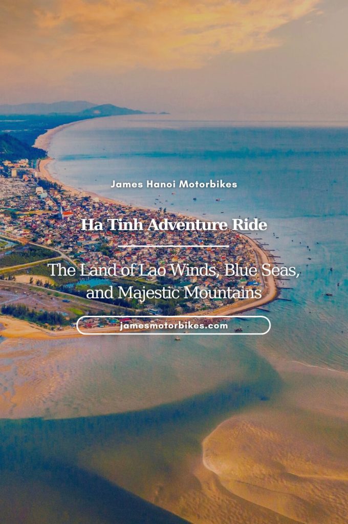
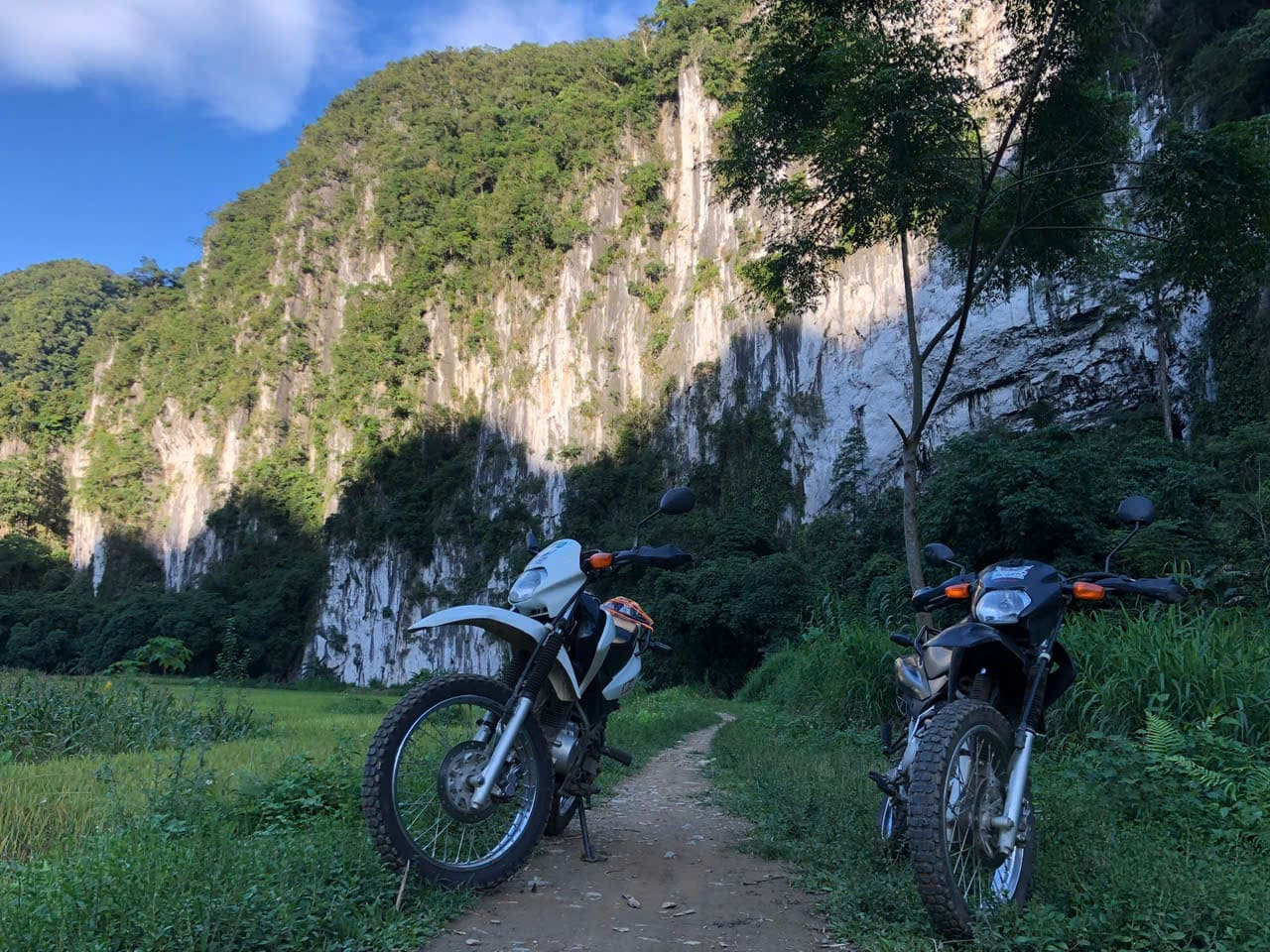
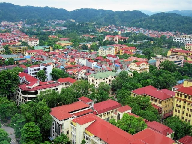
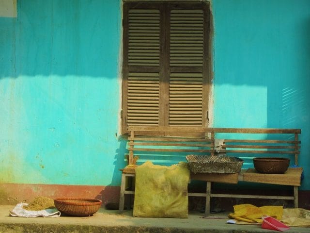
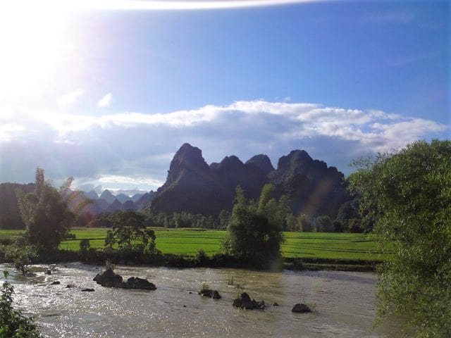
In my opinion, the three northeastern provinces of Cao Bang, Lang Son and Bac Kan currently offer the best on-road motorbiking opportunities anywhere in Vietnam. Why? Because all three northeastern provinces are utterly beautiful – characterized by limestone karsts, unbroken forests, misty mountains, blue rivers, farms, craft villages – and are crisscrossed by a growing network of increasingly good-quality paved back-roads and national highways; tourists are few, traffic is generally very light (with the exception of container trucks plying between remote Chinese border crossings), people are friendly, food is rustic and hearty, opportunities for getting off the beaten path are many, and there’s a real sense of adventure. This guide focuses on five different routes and loops within the three northeastern provinces. Each loop can be ridden separately or stitched together to form a ‘Great Northeast Loop’. Base yourself in Cao Bang, Lang Son, Bac Kan or Ba Be Lake and spend at least a few days exploring these routes by motorbike. The northeast is a great alternative to, or extension of, the Ha Giang Loop, which is now so popular it’s lost some of its magic.
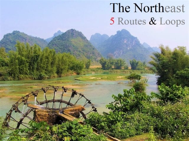
The Northeast: 5 Routes & Loops
In this guide, I’ve mapped, described and illustrated five motorbike loops in the northeastern provinces of Cao Bang, Lang Son and Bac Kan. On the main map, I’ve plotted all five routes in different colours. However, each of the five routes also has its own separate map, which has much more detail, including road conditions, places to stay, see, eat, and drink. Any of these five routes can be mixed and matched and stitched together as and how you like, in order to create longer or shorter loops. All the northeast loops are highly scenic and great fun to ride: I’d recommend spending at least a few days riding them. Weather is best from March to October; it can get cold from November to February. There’s plenty of accommodation in the main northeastern cities and several good homestay areas scattered around (see each separate route map for specific suggestions). For bike rental, QT Motorbikes has a shop in Cao Bang. *[See Related Posts for links to my other motorbike guides in the region]
Map
Northeast by Motorbike: 5 Routes & Loops
Route 1: 165/190km | Route 2: 315km | Route 3: 190km | Route 4: 455km | Route 5: 285km
Route 1: Ban Gioc Waterfall Loop
DETAILS:
- Route: Cao Bang→Ban Gioc Falls→Nguom Ngao Caves (optional return route)
- Distance: 165/190km
- Time: 1-2 days
- Scenery: limestone karsts, minority villages, majestic waterfalls, caves, remote borders
- Road Conditions: good surface, light traffic (some trucks), rough return route (optional)
ROUTE MAP: Ban Gioc Waterfall Loop (165/190km: blue/red route)
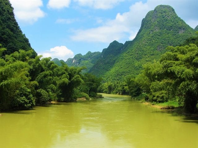
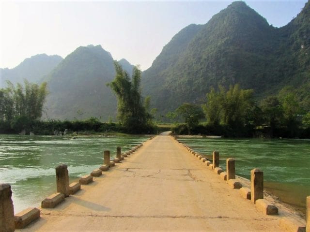
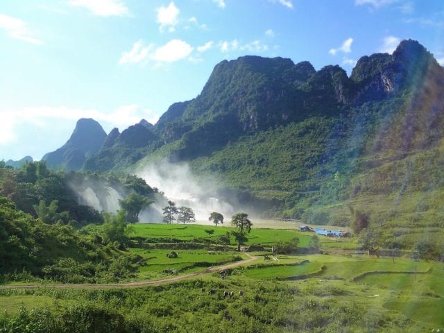
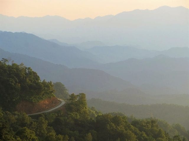
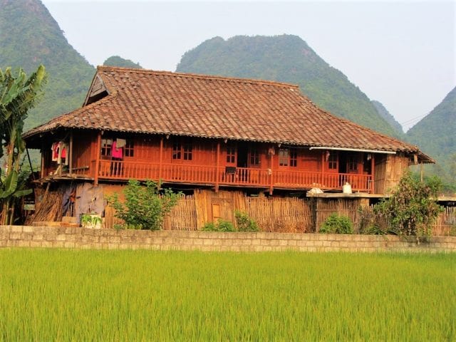
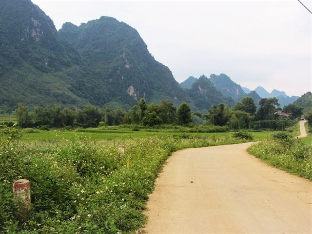
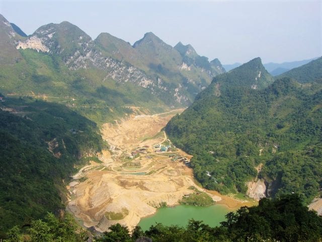
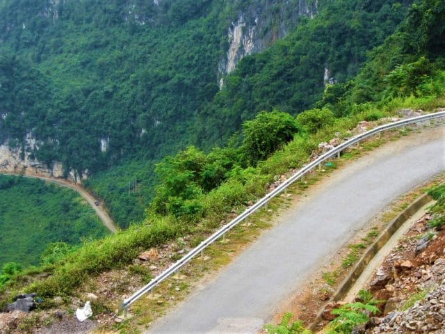
DESCRIPTION: Spreading east of Cao Bang City towards the Chinese border and the spectacular Ban Gioc Waterfall, this loop is the most popular of all the northeast routes. Manageable as a (reasonably long) return day-trip from Cao Bang, the Ban Gioc Waterfall Loop is full of wonderful scenery and good riding roads. However, because of ongoing construction and damaged roads caused by juggernauts plying remote routes to isolated Chinese borders, the lower (southerly) half of the Ban Gioc Loop (the red line) is currently in pretty bad repair, and shouldn’t be attempted unless you have a suitable bike or enough riding experience to tackle some tricky off-road, muddy sections. But, this needn’t concern other riders without a suitable bike or off-road experience, because the ride out to Ban Gioc Falls on the on-road route (the blue line) is so good that you won’t mind retracing your tracks back the same way. Or, even better, break the journey by staying a night at one of the atmospheric homestay areas on the route, such as Dam Thuy or Phia Thap, before returning to Cao Bang the next day.
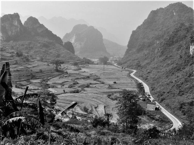
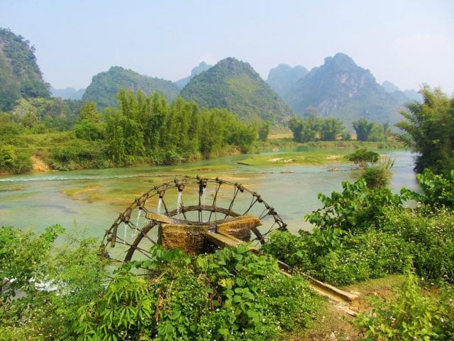
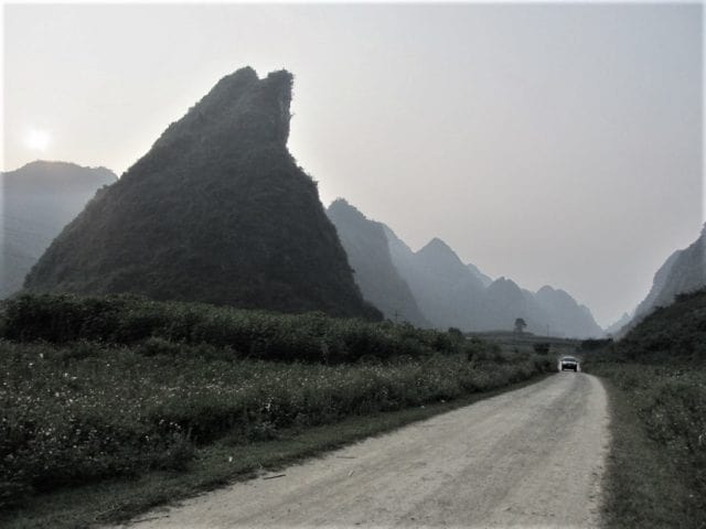
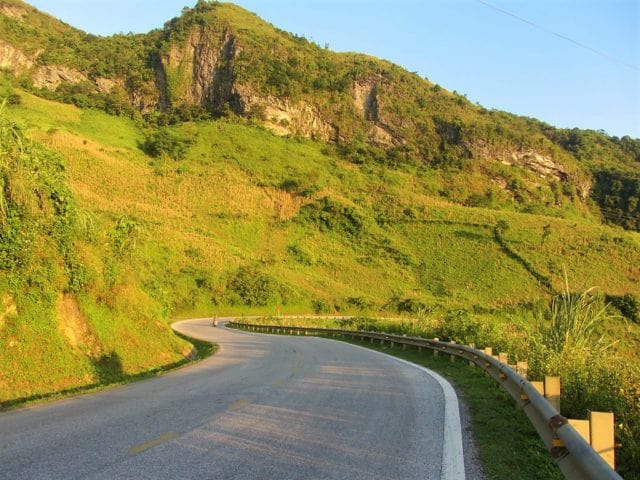
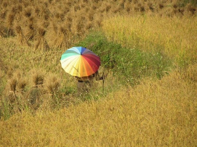
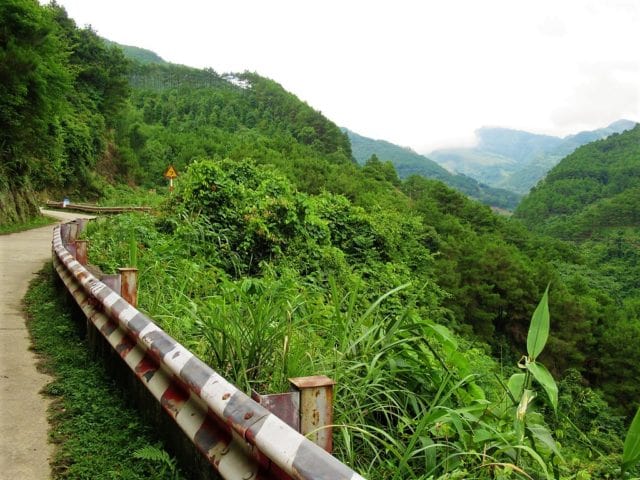
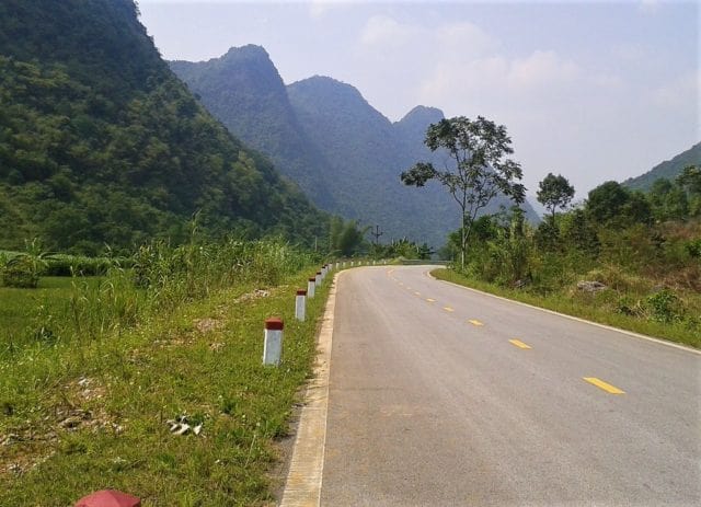
Heading east out of Cao Bang on road QL3, the route passes through lush valleys before ascending the formidable Ma Phuc Pass, which zig-zags up a to a junction where there are marvellous views down over the karst-studded valley. Onward to Quang Uyen, QL3 ploughs through picturesque farmland, where luminous rice paddies fill the flat spaces between limestone pinnacles. Several of the small hamlets specialize in crafts on one kind or another, most noticeably knives, which you’ll see displayed by the roadside. A homestay initiative here, at Phia Thap Village, is worth considering for a night with a local family in a wooden stilt home (try Mr Kim’s Homestay for hospitable hosts, wonderful food, and local knowledge). Quang Uyen, a decent sized town with food and refreshments and a few hotels, is the point at which the route veers north on road DT206, heralding the start of one of the most scenic and enjoyable rides anywhere in Vietnam. All the way between Quang Uyen and Ban Gioc Falls, via the dusty market town of Trung Khanh, the landscape is exceptionally beautiful. Characterized by jagged karst mountains – rising like Daliesque columns from rice paddies and corn fields – and jade-blue rivers flowing past bucolic scenes of wading buffalo, bamboo waterwheels, conical-hatted farmers, stone cottages and wooden cowsheds, the landscape around road DT206 is worthy of any great ink-and-wash Chinese landscape paintings. The road is smooth, easy to ride, and quiet. However, due to soaring trade with China, the peace can be spoiled somewhat by incongruous container trucks struggling up the hairpin bends and squeezing through the tight corners. (A new expressway is currently under construction to address this issue.) It’s also possible to cross the river to the north of DT206 and explore some dusty back-roads.
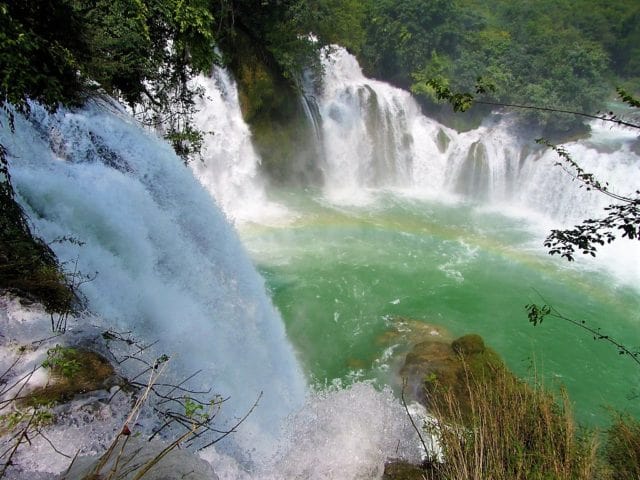
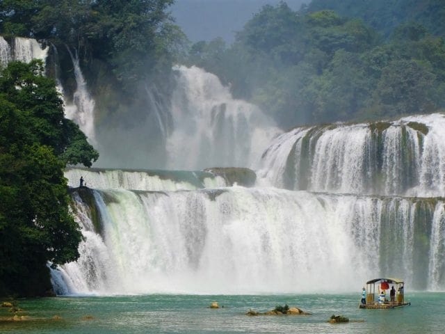
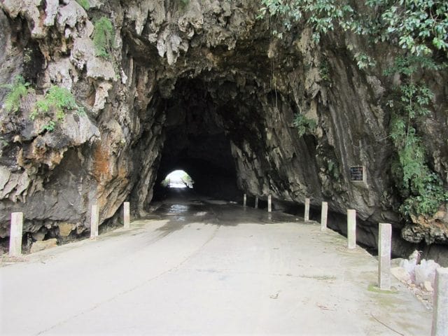
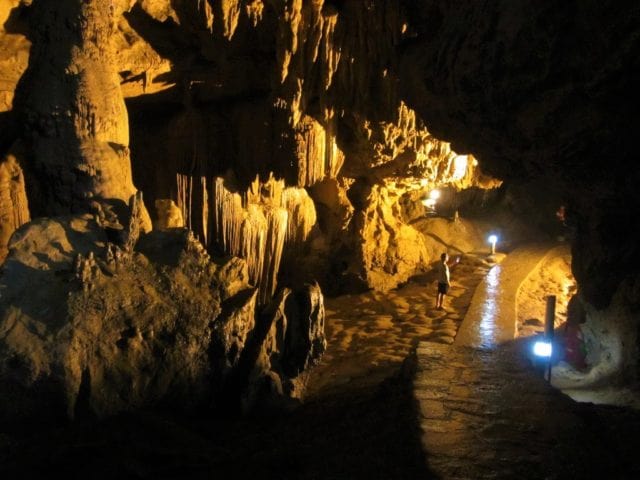
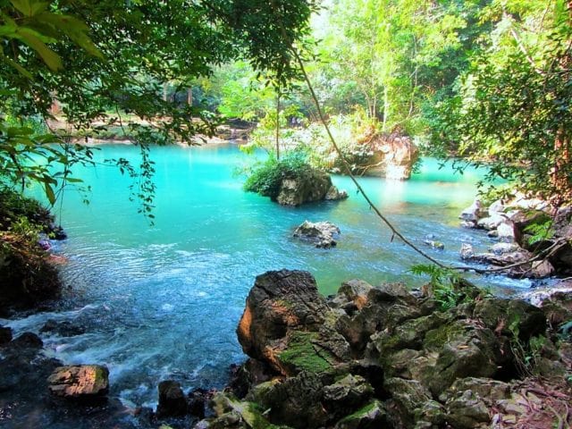
And then, of course, the star of the show: Ban Gioc Waterfall, one of Vietnam’s greatest natural wonders. It appears suddenly in the corner of your eye, then fills your entire vision. Crashing over multiple levels, filling a wide gap in the tropical foliage, the falls tumble down in white-crested layers, like an iced wedding cake. Framed by stands of giant bamboo and jungle-clad limestone karsts, Ban Gioc Waterfall is a genuinely breathtaking sight to behold. The falls lie right on the Chinese border, and there’s also an impressive cave system nearby, Nguom Ngao, with an illuminated trail through it. The Saigon-Ban Gioc Resort offers mid-range accommodation near the falls, and there’s excellent budget beds in the homestays at Dam Thuy Village (try May Linh and Minh Khanh homestays). Providing you have a suitable motorbike and riding experience, you can continue due south from Ban Gioc Falls on roads DT206/DT207 (the red line) along the Chinese border (at times, literally a stone’s throw away) towards Ha Lang (where there’s a guest house, if you should need it) and all the way back to Quang Uyen. This is the real boonies, and well worth the effort if you have the right wheels. If not, return to Cao Bang on the blue route, which, let’s face it, merits a second ride anyway. *[For much more about the waterfall see my Guide to Ban Gioc Falls].
IMAGES: Ban Gioc Waterfall Loop
Route
RouteRour
Route 2: Ba Be Lake Loop
DETAILS:
- Route: Cao Bang→Ba Be Lake→Bac Kan on back roads & highways
- Distance: 315km
- Time: 2-3 days
- Scenery: jungles, lakes, mountains, river valleys, minority villages, homestays
- Road Conditions: paved highways & back roads, very mountainous, rough patches
ROUTE MAP: Ba Be Lake Loop (315km: blue route)
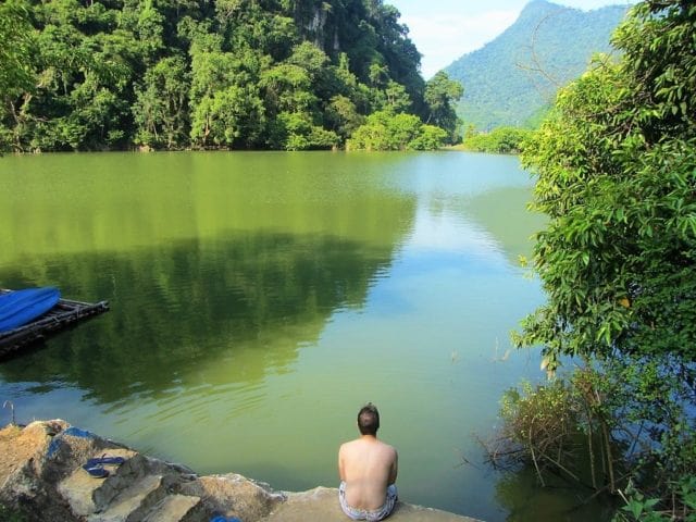
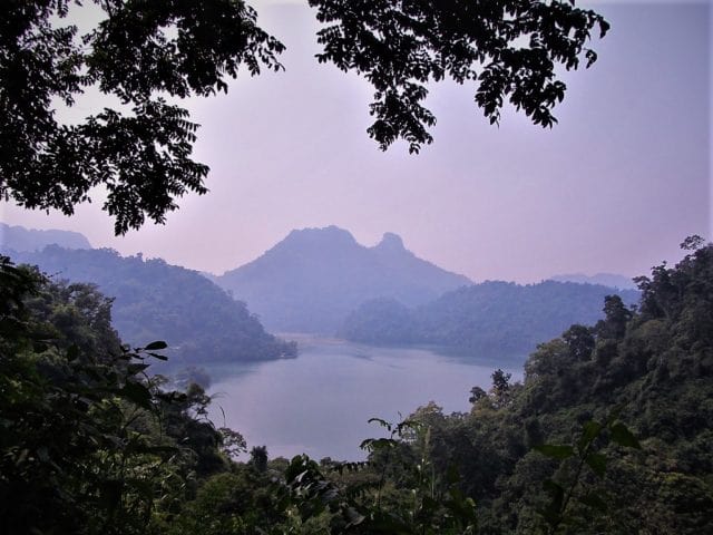
DESCRIPTION: A big, green, mountainous and highly scenic route southwest of Cao Bang, the Ba Be Lake Loop combines snaking national highways with narrow back-roads to create a hugely rewarding ride through jungles, rivers, lakes, and highlands. At 315km, this is a long loop which requires at least one night and two days to complete. However, you can choose to shorten the loop by taking either of the shortcuts (the red lines), effectively cutting the loop in half, and thus making it manageable as a one-day return trip from Cao Bang. But, to really get the most out of this loop, you should spend at least one night at a homestay on the shores of Ba Be Lake, not to mention taking a boat out on the placid water, visiting the caves and sights, and trekking in the countryside. The loop is generally fairly easy to follow and navigate, and road conditions are mostly very good. Two significant exceptions to this are: Road 254 around the eastern and southern shores of Ba Be Lake, and patches of the road leading south from Ba Be Lake to Ban Lanh, both of which have badly potholed sections and suffer from mud after heavy rains.
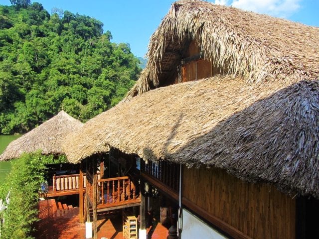
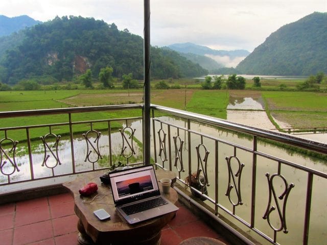
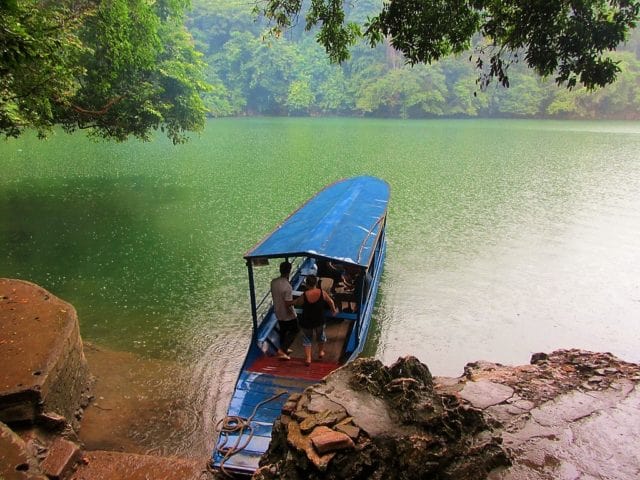
There are several places to stay on the loop, including guest houses in Cho Ra village, and mini-hotels in Bac Kan, the largest town on the route (try Green Hotel, a reliable budget option). However, the homestays on Ba Be Lake are by far the most atmospheric, good value, and rewarding accommodation in the area. Mostly run by local ethnic minority families, these homestays are usually concrete-and-brick or wood-and-thatch structures on stilts by the water’s edge, with easy access to the lake for swimming, kayaking, boat trips, and hiking in the national park. Thus, these homestays are the main hub for activities and sightseeing on the Ba Be Lake Loop. Mr Linh’s and Hoa Son homestays are good options, but there are dozens of others. *[For more information see my Guide to Ba Be Lake Homestays].
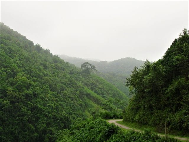
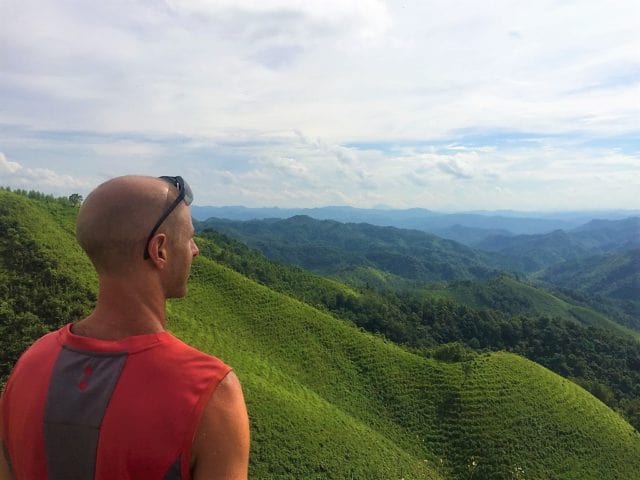
The most scenic sections of the loop are, well, they’re all fantastically scenic: Road QL34 west of Cao Bang to Tinh Tuc mining town is a serpentine ribbon of asphalt burrowing deep into the northern mountains; Road DT212 soars over cold, windy passes beneath the slopes of one of the highest mountains in the region, Pia Oac, before plunging due south past a high-end tea plantation, Kolia, and abandoned, century-old, French colonial-era villas to Cho Ra; all the roads to, from, and around Ba Be Lake are dripping with tropical foliage, rivers oozing out of the jungles from the high peaks of limestone mountains, the entire area heavy with an earthy dampness and a strong, mysterious presence as the landscapes wax and wane behind curtains of mist and rain; and Road QL3 back to Cao Bang is a long and dizzying ride through sublime scenery on a smooth surfaced national highway – one of the best riding roads in Vietnam. The riding is good, the scenery stunning, tourists are few, traffic is light: go now and make the most of it.
IMAGES: Ba Be Lake Loop
Route 3: Mau Son Mountain↔Bac Son Valley Loop
DETAILS:
- Route: Lang Son→Mau Son Mountain→Dong Dang border→Bac Son Valley
- Distance: 190km
- Time: 1-2 days
- Scenery: misty mountains, limestone karsts, rivers, minority villages, homestays
- Road Conditions: good, paved surfaces, some rough patches, light traffic
ROUTE MAP: Mau Son Mountain↔Bac Son Valley Loop (190km: blue & red route)
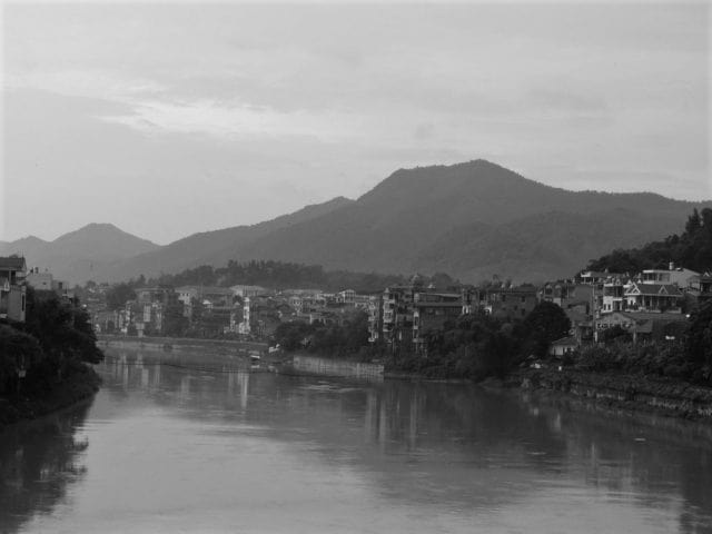
DESCRIPTION: Two scenic, mountainous loops connected by a smooth ride along a picturesque river valley, the Mau Son Mountain↔Bac Son Valley Loop is relatively short, fairly easy to navigate, and generally on good, well-made roads. However, there are a couple of rough road sections, which I’ve marked on my map with red lines or roadworks icons. Even these sections should be OK to ride in dry weather, but if wet they can become quite difficult. Start from Lang Son, a city that’s prospered on the back of increased trade with China. A small and friendly place with a pleasant buzz on its streets, Lang Son has lots of food, hotels, several sights and great markets selling all sorts of goods from across the border (see my map for suggestions of all the above).
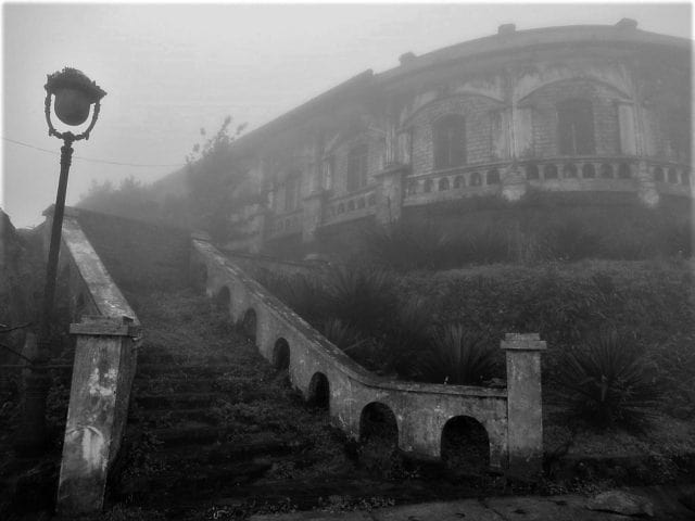
Head east of the city on Road QL4B, leading through a pleasant valley, to the turnoff for DT237B, which climbs all the way to the summit of Mau Son. The road twists through jungle and pines high into the clouds, but is currently (2021) undergoing major renovations, so expect delays, dust and mud. At the top, a collection of restored and faux French colonial villas are all that’s left of an unlikely former hill station. It’s a bizarre and romantic sight. Several of the buildings offer accommodation, food, and drink, including the famous local liquor (ruọu), made special, supposedly, by the purity of the mountain spring water. If the weather is clear, the views are mind-blowing. But, Mau Son is almost permanently wrapped in cloud and mist, giving it an eerie, haunted, ethereal character. Either way, it’s well worth the journey. Just don’t come on a weekend or public holiday, when the crowds are insane; during the week, there’s hardly anyone here. The government intend to turn Mau Son into a tourist attraction on the grand, kitsch scale of Ba Na Hills, near Danang. So if that’s not your thing (it isn’t mine), visit now. From just below the summit it’s possible to loop back to Lang Son via a small paved mountain road heading north to Hai Yen, then connecting with Road DT235.
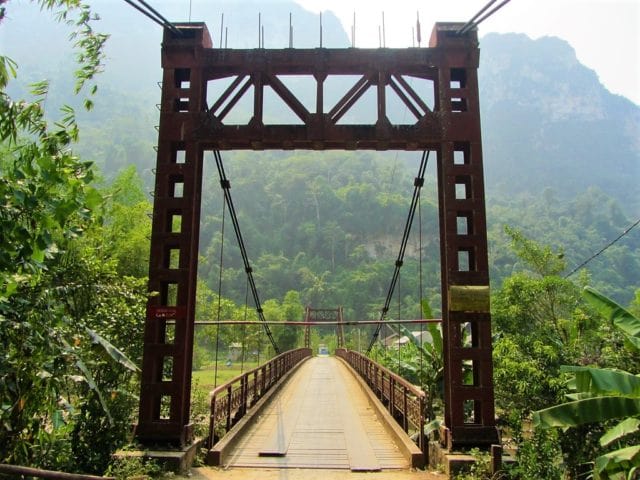
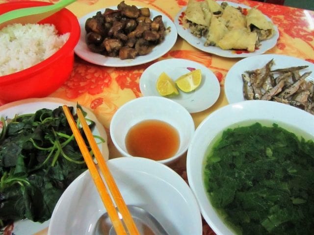
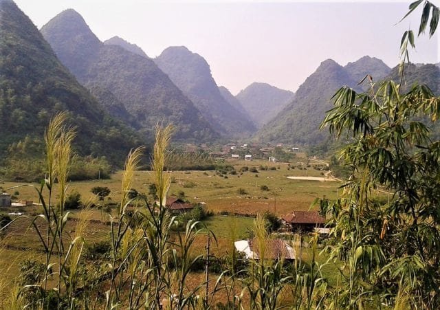
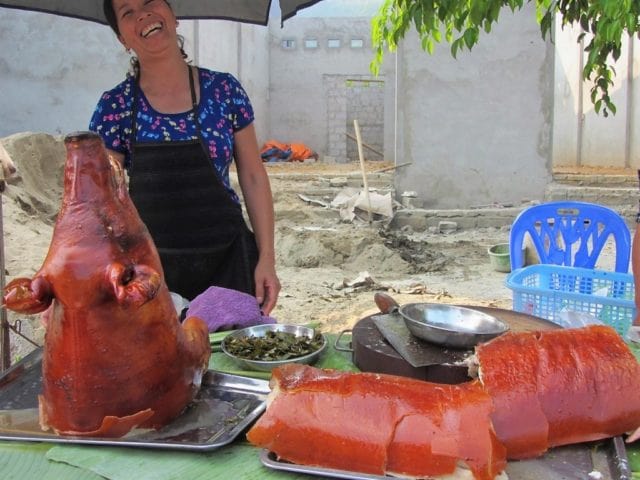
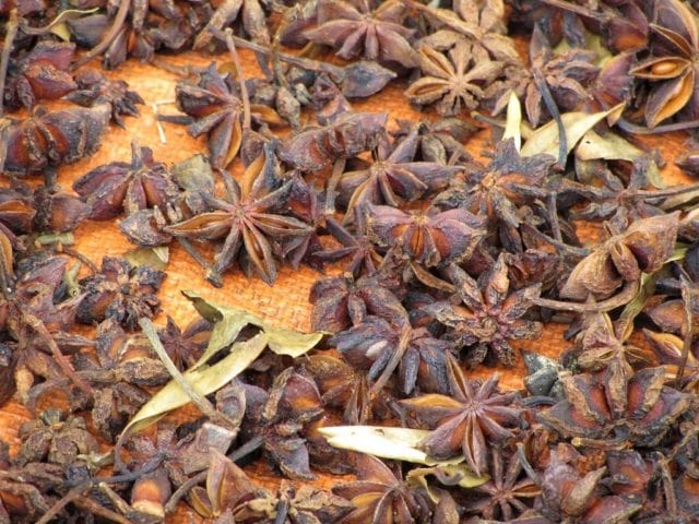
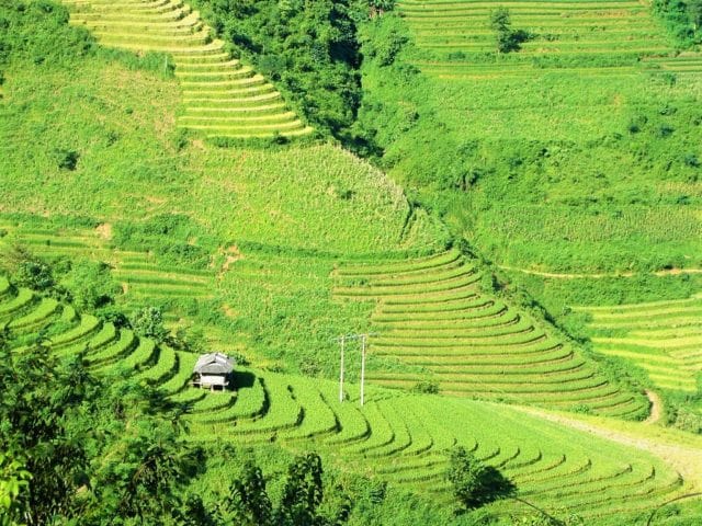
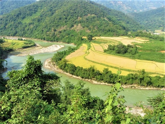
Pass back through Lang Son and start heading due west. There are two choices for this: take the smooth but busy Highway QL1A north towards Dong Dang then connect with QL1B heading due south and west; or take the more direct but potholed and muddy route on Road DT235C west of Lang Son before joining QL1B. Either way, it’s not long before you’re gliding through a pretty valley on QL1B, a fantastic riding road: smooth, clear, scenic and fast, brushing by a clear-flowing river, fragrant rice fields and limestone peaks. In season, the air here is scented with Star Anise, an aromatic spice that’s one of the ‘secret’ ingredients of phở. After Binh Gia village, the road climbs steadily, slicing through a cluster of forested limestone karsts, affording fabulous views down into the valley, where smoke rises from little hamlets of wood-and-tile houses. Bac Son lies at the bottom of the pass, a flat, rice-growing valley enclosed by a cradle of limestone karsts. The town itself is small and unassuming, but on its eastern periphery, where the rice fields are so brightly coloured it’s as if each blade has been charged with an electric current, there’s a homestay initiative, at Quynh Son hamlet. Staying in the wooden stilt houses here with a local ethnic minority family is a rewarding experience. Expect to pay around 200,000vnd for a night in a wooden house, including delicious home-cooked food.
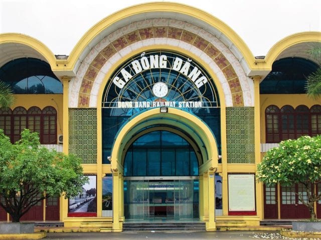
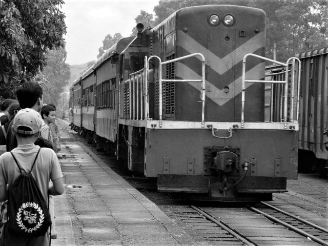
However, before bedding down for the night in a homestay, ride the bucolic loop around Bac Son Valley, by combining roads QL1B with DT241 (note that the latter suffers from potholes). This 60km scenic ride wiggles between limestone pinnacles that break up oceans of rice paddy, bisected by a wide river. If you get hungry, look out for roadside vendors near Nga Hai selling tasty sides of crispy roast pork. Finally, save some energy for the steep climb through thick jungle to the Bac Son View Point, atop a limestone crag behind the town, for stunning views of the entire valley. After a night in a homestay, retrace your route back along the valley on QL1B to Lang Son to complete the double loop. However, it’s worth stopping in the intriguing border town of Dong Dang on the way for an hour, to soak up the strange atmosphere. Dong Dang train station is a fascinating building with an exhibition of Kim Jong-un’s visit in early 2019; Dong Dang Market has lots of Chinese goods; Dong Dang temple is a colourful, multi-storey pagoda; and the Friendship Border Gate is a busy trading post, choked with container trucks.
IMAGES: Mau Son Mountain↔Bac Son Valley Loop
Route 4: Bac Kan Back Roads Criss–Cross Loop
DETAILS:
- Route: Cao Bang→Bac Kan→Lang Son via a criss-cross of rural back roads
- Distance: 455km
- Time: 2-3 days
- Scenery: deep forests, mountains, sparsely populated river valleys, minority villages
- Road Conditions: good surfaces, back roads & national highways, light traffic
ROUTE MAP: Bac Kan Back Roads Criss-Cross Loop (455km: blue route)
DESCRIPTION: A long, densely forested and sparsely populated route through landscape, and on roads, that most travellers don’t see, the Bac Kan Back Roads Criss-Cross Loop connects the three main northeastern cities (Cao Bang, Lang Son, and Bac Kan) via a series of overlapping back roads, offering a chance to get way off the beaten path while sticking to good, sealed roads. With the exception of Road QL4A between Cao Bang and Lang Son, which forms the eastern flank of this route, the Bac Kan Criss-Cross Loop utilizes several excellent, seldom used back roads that have all recently been resurfaced, providing easy riding and plugging you into isolated areas of thick jungles, rivers, and seemingly endless mountains. Start/end in either Cao Bang or Lang Son (it doesn’t matter which) and take your time eating up the miles on the ‘criss-cross’ of back-roads, meandering through one of the least populated provinces in Vietnam, past countryside rich in revolutionary history. This is the heart of the Việt Bắc region, historically a revolutionary stronghold, not least in the mid-twentieth century, when Ho Chi Minh and his entourage avoided detection from French authorities by taking cover in the tangle of steep valleys and forests. The riding is fabulous, the traffic is light, the scenery pristine, and the distances long but easily manageable in a couple of days, with an overnight stop in Bac Kan (try Green Hotel for a reliable budget option) or one of the local guest houses (nhà nghỉ) in the small villages on the back roads.
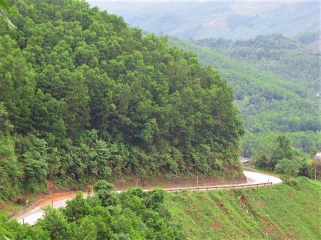
To the east of this loop is a long stretch on Highway QL4A. An ambitious, wide, smooth road, facilitating trade with China, QL4A is fun to ride as it curls over passes, along steep valleys, and through pretty farmland punctuated by limestone karsts. However, it’s marred by container trucks plying between Chinese border posts; the juggernauts often stalling as they crawl painfully up the passes. Indeed, a new expressway is under construction to address this issue, but won’t be completed for some time. Nonetheless, it’s still a decent and fast ride, linking two of the northeast’s major cities: Cao Bang and Lang Son. Stop in at Dong Dang, the main Chinese border town, for a look at its market and impressive train station. This is where Kim Jong-un entered Vietnam for his summit with President Trump in February 2019. The station features an exhibition of photographs commemorating the event. There’s also an interesting temple, and it’s worth riding up to the border to have a look at the imposing gates and hundreds of waiting freight vehicles.
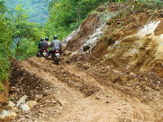
Almost exactly in the middle of QL4A, the town of That Khe is the turnoff point for the ‘criss-cross’ of back roads. You can ride the ‘criss-cross’ in any direction, it really doesn’t matter. This is the point where the roads melt into the jungle: a network of connecting back roads twisting and turning through an incredibly lush, fecund, fertile landscape of rivers, jungles, mountains and karsts. All the back roads are now paved, although their condition deteriorates at certain points and, because the terrain is so mountainous, the roads are liable to suffer from landslides after heavy rain. But, in good weather, all riders on all bikes should be able to relax and enjoy these highly scenic, rural back roads. Gas stations are few, but each village has at least one. The same goes for food and accommodation: one or two local guest houses (nhà nghỉ) can be found in the villages marked with a red pin on my map, but it’s best to save your overnight stop for Bac Kan, where there are plenty of small hotels, including Green Hotel & Coffee. Settle into the ride and become pleasantly disorientated in the tropical foliage of Bac Kan Province.
IMAGES: Bac Kan Back Roads Criss-Cross Loop
Route 5: China Border Crawl Loop
DETAILS:
- Route: Cao Bang→Bao Lac→Pac Bo Cave→Ma Phuc Pass via border back roads
- Distance: 285km
- Time: 2-3 days
- Scenery: mountains, incredible passes, remote borders, rivers, villages, historic sites
- Road Conditions: decent back roads, bad patches, susceptible to landslides, light traffic
ROUTE MAP: China Border Crawl Loop (285km: blue route)
DESCRIPTION: The most northerly of the five northeast routes, the China Border Crawl Loop is a mountainous circuit from Cao Bang, utilizing remote and extraordinarily steep and twisted roads, often clinging to an isolated section of the Chinese border. Although the China Border Crawl Loop is long and winding, it is possible to ride the entire loop in a long day on the road, providing you leave early and have good weather. However, it’s more enjoyable to take your time, breaking the journey at one of the mini-hotels in Bao Lac for a night. Alternatively, you can cut the loop in half by taking either of the two shortcuts (the red lines) back to Cao Bang. The scenery is fantastic, the roads are astonishing, and the sense of adventure is real and raw.
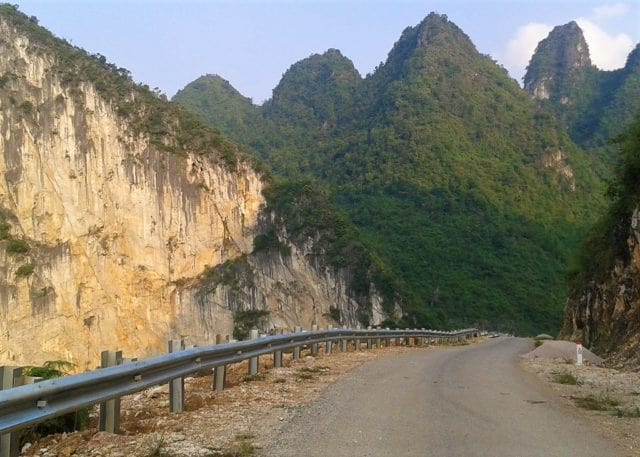
Heading west from Cao Bang, Road QL34 is a wonderfully knotted ribbon of tarmac, corkscrewing up green mountains of terraced rice fields, soaring over cold, high passes, and plummeting into tight valleys all the way to Bao Lac. A small town at the confluence of several rivers, Bao Lac is a good place to grab refreshments or a bed for a night (I’ve marked several hotels on my map), before riding due east on what is one of the most astonishing roads in the country. Following the Gam River east of Bao Lac, this as yet unnamed road is currently the talk of many riders in Vietnam. Hugging the Chinese border for much of its length, the road passes through some extremely remote landscapes. As if the fabulous scenery weren’t enough, the road itself is quite a sight. The narrow asphalt lane is full of contortions and knots; constantly switching back on itself as it negotiates the difficult terrain. To look at it on the map it’s as if the road were alive: an agitated dragon, shifting violently from left to right, trying to shrug an assailant off its back. One pass, in particular, is breathtaking: Ascending what is essentially a vertical wall of rock, the road passes 14 (by my count) consecutive switchbacks. I’ve taken to calling this the ‘Dragon’s Stairway’ or ‘Roller Coaster Pass’ (I’ve never been able to decide between the two). However, Google Maps has recently named it đèo Mẻ Pia.
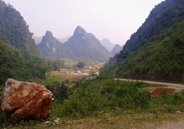
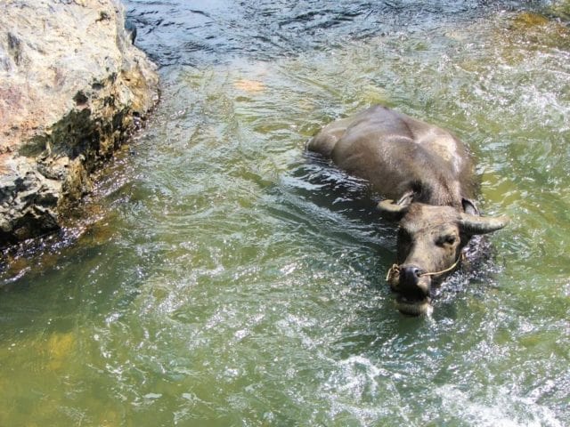
At times gravelly and potholed, this border road runs all the way east through Can Yen village until it hits the Ho Chi Minh Road (DT208), just south of Pac Bo Cave. Definitely worth the short detour, Pac Bo is a significant historical site in a highly scenic location. This is where Uncle Ho re-entered Vietnam in 1941, after 30 years of absence, to begin his struggle for an independent nation. (See my Guide to Pac Bo Cave for details.) To continue on the loop, turn east on DT210, a seldom used back road climbing sharply up limestone cliffs and shadowing the Chinese border to Tra Linh. Cutting a huge white gash in the landscape, the narrow road twists through a forest of chalky limestone karsts, passing through remote villages that appear to be stuck in time. Homes are made of packed mud and straw with baked-tile roofs; oxen, buffalo, and horses transport crops, farm equipment, and people from field to village; stone walls divide fields of rice, corn, and soy beans; hay is stacked by children into 20-foot-high pylons, echoing the shape of the limestone hills; and a rocky creek ekes through the valley, providing animals and farmers with a bath after a hard day’s work on the land. At Tra Linh, turn due south onto Road DT205 (perhaps stopping at Thang Hen Lake on the way) and connect up with QL3 at the Ma Phuc Pass, heading all the way back to Cao Bang.
IMAGES: China Border Crawl Loop
Source of the article: Vietnam Coracle